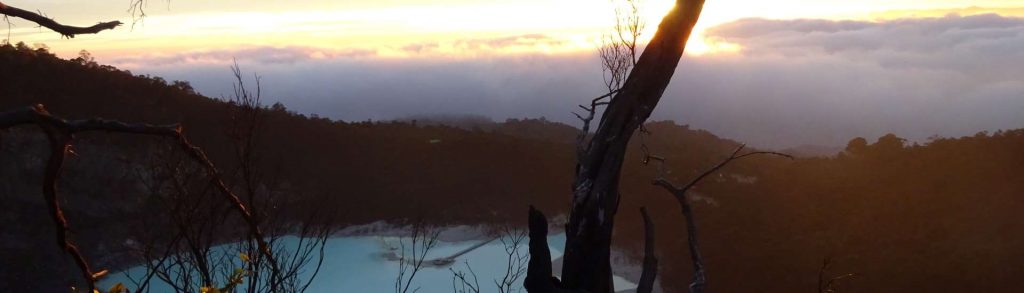
Author name: Dan

Gunung Santubong

Facts Elevation: 850 m (2,789 ft) Prominence: 850 m Peak category:  Spesial Region:  Sarawak Division: Bahagian Kuching Coordinates: 1.7367, 110.3333 Rating: Photos Bagging It! For hikers spending a few days in the Kuching area, Gunung Santubong is a great half-day out, and even closer to Kuching city itself than Penrissen, for example. It is a very steep

Gunung Santubong Read More »

Gunung Kalulong

Facts Elevation: 1,600 m (5,249 ft) Prominence: 1,149 m Ribu category:  Kurang Tinggi Region:  Sarawak Division: Bahagian Miri Coordinates: 3.2200, 114.6708 Rating: World Ribus ID: 69155 Bagging It! Very little is known about Gunung/Gunong or Bukit Kalulong, although it has been climbed at least a couple of times by scientific researchers. Apparently in 1932 the then Curator

Gunung Kalulong Read More »

Gunung Murud Kecil

Facts Elevation: 1,626 m (5,335 ft) Prominence: 1,020 m Ribu category:  Kurang Tinggi Region:  Sarawak Division: Bahagian Miri Coordinates: 3.3342, 115.1367 Rating: World Ribus ID: 69212 Bagging It! Despite the name meaning ‘small Murud’, Murud Kecil is not especially close to the much taller Gunung Murud. It has been climbed at least on a handful of occasions

Gunung Murud Kecil Read More »

Gunung Monkobo

Facts Elevation: 1,830 m (6,004 ft) Prominence: 1,303 m Ribu category:  Kurang Tinggi Region:  Sabah Division: Bahagian Sandakan Coordinates: 5.8200, 116.9550 Rating: World Ribus ID: 69117 Photos Bagging It! Not much is known about Gunung Monkobo at present and it does not appear to be hiked regularly. In 2022, it was confirmed by local villagers that there

Gunung Monkobo Read More »

Bukit Teraja

Facts Elevation: 412 m (1,352 ft) Prominence: 332 m Peak category:  Spesial Region: Brunei Coordinates: 4.3055, 114.4347 Rating: Other names: Mount Scott Bagging It! Bukit Teraja is probably the best out of a fairly small number of trekking options in Brunei. A half-day outing, but a full day from Bandar Seri Begawan and back given the

Bukit Teraja Read More »

Gunung Bukittunggul

BUKITTUNGGUL

Gunung Bukittunggul is the highest peak in the mountainous area north of the city of Bandung, higher than both Tangkuban Parahu and Burangrang which lie further west. It is a major landmark when seen from other hills in the Bandung area and can be easily reached and climbed as a daytrip from Bandung or even Jakarta. Whilst there are no views to be had at the forested summit, the trek is not yet as hugely popular as most other significant peaks surrounding Bandung so if you are searching for relative solitude then this is a great choice.

Gunung Bukittunggul Read More »

Raung

Gunung Raung – Puncak Sejati

RAUNG

At over 2 kilometres in diameter, Gunung Raung has the largest crater in Java. It’s one of the most remote and least climbed of the 3000-metre plus peaks which means that there isn’t much litter on the trail and it really is a mountain to escape from civilization for a while. Whilst reaching the true highest point of Raung crater rim requires a 3-day expedition involving roped rock climbing, the most popular route to the rim itself is from the north at Sumberwringin.

Gunung Raung – Puncak Sejati Read More »

Gunung Karang

KARANG

After Gunung Halimun which borders West Java, Gunung Karang is the highest peak in Banten. There are two separate trails on the mountain both of which can be done as half-day hikes. The first leads to the forested summit with a mosque on top, and the second leads to a rarely-visited crater area.

Gunung Karang Read More »

Scroll to Top