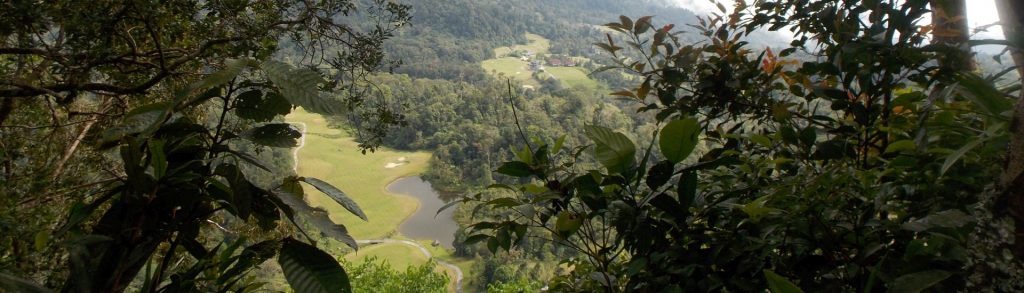
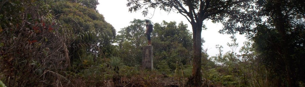
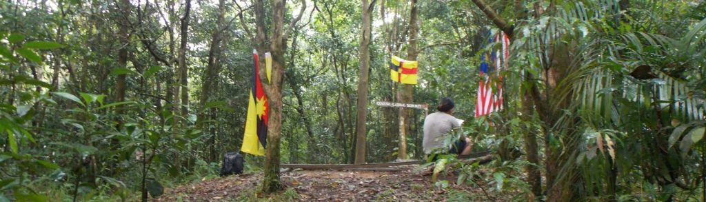
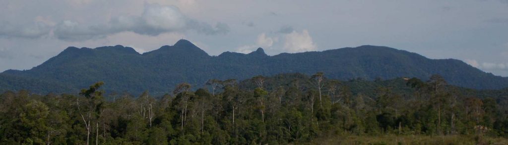
Sarawak (Malaysia)

Bukit Pagon

Facts Elevation: 1,875 m (6,152 ft) Prominence: 955 m Ribu category: Spesial Province: Sarawak (Malaysia) Division: Bahagian Limbang Google Earth: kml Rating: Other names: none Bagging It! Bukit Pagon (‘Pagon Hill’) is moderately famous for being the highest mountain in the small country of Brunei. In recent years it has been climbed on several occasions, […]

Bukit Pagon Read More »

Gading (Perigi)

GADING (PERIGI)

The Gunung Gading National Park near Lundu is world-famous for its Rafflesia flowers which regularly bloom near the Park headquarters. During those times, tourists flock to see the largest flower in the world but it can be difficult to predict and the blooming period is very short. It seems to be most common in November, December, February and March but can happen at any time of the year. There is also some very good trekking in the Park.

Gading (Perigi) Read More »

Serapi

SERAPI

Gunung Serapi is located in Kubah National Park and is near to the Matang wildlife sanctuary. At 911m, it is the tallest peak in the Kuching area. It can easily be climbed in a single day, as most hikers complete the trek in 5 hours or less and it is a very popular jogging spot. The mountain is actually known as the Matang range, and Serapi is the highest peak of the range.

Serapi Read More »

Tutoh

Facts Elevation: 1,265 m (4,150 ft) Prominence: 999 m Ribu category: Spesial Province: Sarawak (Malaysia) Range: Banjaran Mulu Division: Bahagian Miri Google Earth: kml Rating: Other names: Bukit Pelamau Bagging It! This peak is on the other side of the Tutoh river from the main Mulu range. It may have a completely different name –

Tutoh Read More »

Banjaran Dulit

Facts Elevation: 1,461 m (4,793 ft) Prominence: 1,148 m Ribu category: Kurang Tinggi Province: Sarawak (Malaysia) Division: Bahagian Kapit Google Earth: kml Rating: Other names: none. Bagging It! Unknown. Hiked by Hose in 1891 but almost certainly not to the highest peak in the range. Practicalities Getting there: Unknown at present Accommodation: Unknown at present

Banjaran Dulit Read More »

Kana

Facts Elevation: 1,073 m (3,520 ft) Prominence: 1,019 m Ribu category: Kurang Tinggi Province: Sarawak (Malaysia) Division: Bahagian Bintulu Google Earth: kml Rating: Other names: none. Bagging It! Bukit Kana gives its name to the Bukit Kana National Park near Tatau where there is a scientific research station. It appears to not yet be open

Kana Read More »

Kalulong

Facts Elevation: 1,600 m (5,249 ft) Prominence: 1,149 m Ribu category: Kurang Tinggi Province: Sarawak (Malaysia) Division: Bahagian Miri Google Earth: kml Rating: Other names: none. Bagging It! Very little is known about Gunung/Gunong or Bukit Kalulong, although it has been climbed at least a couple of times by scientific researchers. Apparently in 1932 the

Kalulong Read More »

Murud Kecil

Facts Elevation: 1,626 m (5,335 ft) Prominence: 1,020 m Ribu category: Kurang Tinggi Province: Sarawak (Malaysia) Division: Bahagian Miri Google Earth: kml Rating: Other names: none. Bagging It! Despite the name meaning ‘small Murud’, Murud Kecil is not especially close to the much taller Gunung Murud. It has been climbed at least on a handful

Murud Kecil Read More »

Batu Lawi

Facts Elevation: 2,046 m (6,713 ft) Prominence: 400 m Ribu category: Spesial Province: Sarawak (Malaysia) Range: Kelabit Highlands Division: Bahagian Limbang Google Earth: kml Rating: Other names: Batu Lawih Photos Bagging It! Batu Lawi, also spelt ‘Lawih’, is one of Borneo’s most iconic mountains, with two steep sandstone summit pinnacles. It can be clearly seen

Batu Lawi Read More »

Santubong

Facts Elevation: 850 m (2,789 ft) Prominence: 850 m Ribu category: Spesial Province: Sarawak (Malaysia) Division: Bahagian Kuching Google Earth: kml Rating: Other names: none. Photos Bagging It! For hikers spending a few days in the Kuching area, Gunung Santubong is a great half-day out, and even closer to Kuching city itself than Penrissen, for

Santubong Read More »

Scroll to Top