Kurang Tinggi

Gunung Kujau

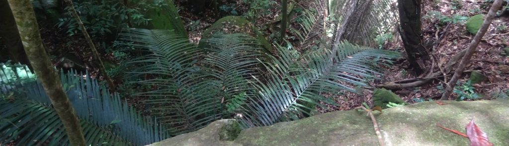
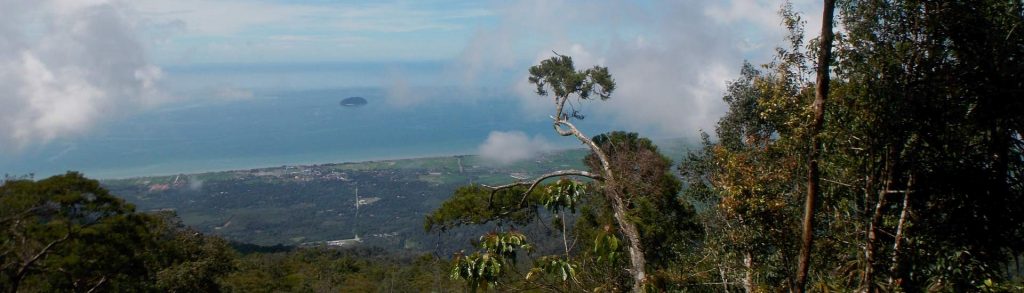
Facts Elevation: 1,308 m (4,291 ft) Prominence: 1,101 m Ribu category:  Kurang Tinggi Province:  Kalimantan Barat (West Kalimantan) Coordinates: -0.2258, 111.2667 Rating: World Ribus ID: 69178 Photos Bagging It! Gunung Kujau is located to the north of the larger Gunung Saran. Kujau’s elevation is listed as 1,322m on an old US Army Map but local hikers suggest […]

Gunung Kujau Read More »

Sangeang Api

Facts Elevation: 1,949 m (6,394 ft) Prominence: 1,949 m Ribu category:  Kurang Tinggi Province:  Nusa Tenggara Barat Coordinates: -8.1959, 119.0698 Rating: Other names: none Eruptions: 1512, 1715, 1821, 1860, 1911-12, 1927, 1953-58, 1964, 1966, 1985, 1997, 2009, 2014, 2017-18 World Ribus ID: 69039 Photos Bagging It! Gunung Sangeang (or Sangeang Api) is a very active island volcano,

Sangeang Api Read More »

Gunung Niut

Facts Elevation: 1,682 m (5,518 ft) Prominence: 1,639 m Ribu category:  Kurang Tinggi Province:  Kalimantan Barat (West Kalimantan) Coordinates: 1.0025, 109.9333 Rating: World Ribus ID: 69067 Photos Bagging It! UPDATE: As of 2017, hikers need to email the relevant authorities below to request permission to hike Gunung Niut. This peak gives its name to the Gunung Nyiut-Penrissen

Gunung Niut Read More »

Huidu Matabulawa

Facts Elevation: 1,964 m (6,444 ft) Prominence: 1,756 m Ribu category:  Kurang Tinggi Province:  Sulawesi Utara (North Sulawesi) Coordinates: 0.4902, 123.6735 Rating: World Ribus ID: 69052 Bagging It! Huidu Matabulawa (1,964m) on the Bakosurtanal map. We currently know very little about this peak – please contact us if you can provide any information.

Huidu Matabulawa Read More »

Co Ta Roun

Facts Elevation: 1,623 m (5,325 ft) Prominence: 1,123 m Ribu category:  Kurang Tinggi Region:  Southern Lao /  Central Vietnam Coordinates: 17.2944, 106.3000 Rating: World Ribus ID: 68639 Bagging It! Currently unknown. Practicalities Getting there: Currently unknown. Permits: Currently unknown. Water sources: Currently unknown. Local Average Monthly Rainfall (in Danang) Location   Click on the blue arrow (top right)

Co Ta Roun Read More »

Pha Luong

Facts Elevation: 1,890 m (6,201 ft) Prominence: 1,127 m Ribu category:  Kurang Tinggi Region:  Northern Lao /  Northern Vietnam Coordinates: 20.6725, 104.6350 Rating: World Ribus ID: 68638 Bagging It! Currently unknown. Practicalities Getting there: Currently unknown. Permits: Currently unknown. Water sources: Currently unknown. Local Average Monthly Rainfall (in Hanoi) Location   Click on the blue arrow (top right)

Pha Luong Read More »

Phou Hindam

Facts Elevation: 1,915 m (6,283 ft) Prominence: 1,155 m Ribu category:  Kurang Tinggi Region:  Northern Lao /  Northern Vietnam Coordinates: 20.4317, 104.6158 Rating: World Ribus ID: 68629 Bagging It! Currently unknown. Practicalities Getting there: Currently unknown. Permits: Currently unknown. Water sources: Currently unknown. Local Average Monthly Rainfall (in Hanoi) Location   Click on the blue arrow (top right)

Phou Hindam Read More »

Gunung Mundo Perdido

Facts Elevation: 1,763 m (5,784 ft) Prominence: 1,223 m Ribu category:  Kurang Tinggi Region:  Timor-Leste (East Timor) Coordinates: -8.7233, 126.3225 Rating: World Ribus ID: 69134 Photos Bagging It! Gunung Mundo Perdido (1,763 m) offers a lovely one-day trek, although reaching its true summit is probably much more difficult. Mundo Perdido (Portuguese) literately means ‘Lost World’. The name

Gunung Mundo Perdido Read More »

Gunung Kajang

KAJANG

Tioman is the only significantly mountainous island of several scattered off Peninsular Malaysia’s east coast. Despite being a popular holiday island, the forest remains very wild and is home to some endemic species. Most visitors to Tioman get their first view of the island’s peaks from the boat over from Mersing.

Gunung Kajang Read More »

Gunung Jerai

JERAI

Gunung Jerai is a very striking limestone mountain surrounded by flat land and located on Malaysia’s west coast. In ancient times it was used as a navigational aid by traders from overseas and allegedly was once an island called Pulau Serai. It was also previously known as ‘Kedah Peak’ and is normally clearly visible from Penang.

Gunung Jerai Read More »

Scroll to Top