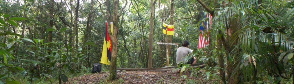
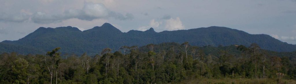
Spesial

Gunung Yong Belar

YONG BELAR

Gunung Yong Belar is the second-highest peak in the huge Titiwangsa mountain range and only a couple of metres below the highest which is Gunung Korbu. It is a popular hike during weekends, usually with several groups hoping to complete a trek to one of Peninsular Malaysia’s highest peaks in a single day or two days and one night.

Gunung Yong Belar Read More »

Rakata

Facts Elevation: 813 m (2,667 ft) Prominence: 813 m Peak category:  Spesial Province:  Lampung Coordinates: -6.1458, 105.4400 Rating: Photos Bagging It! Rakata is the highest of the Krakatau islands in the Sunda Strait between Java and Sumatra. It is the remnants of the only one of three volcanoes (Perboewatan, Danan and Rakata) which formed Krakatau to not

Rakata Read More »

Gunung Gading – Gunung Perigi

GADING (PERIGI)

The Gunung Gading National Park near Lundu is world-famous for its Rafflesia flowers which regularly bloom near the Park headquarters. During those times, tourists flock to see the largest flower in the world but it can be difficult to predict and the blooming period is very short. It seems to be most common in November, December, February and March but can happen at any time of the year. There is also some very good trekking in the Park.

Gunung Gading – Gunung Perigi Read More »

Gunung Serapi

SERAPI

Gunung Serapi is located in Kubah National Park and is near to the Matang wildlife sanctuary. At 911m, it is the tallest peak in the Kuching area. It can easily be climbed in a single day, as most hikers complete the trek in 5 hours or less and it is a very popular jogging spot. The mountain is actually known as the Matang range, and Serapi is the highest peak of the range.

Gunung Serapi Read More »

Gunung Burangrang

Facts Elevation: 2,064 m (6,772 ft) Prominence: 425 m Peak category:  Spesial Province:  Jawa Barat (West Java) Coordinates: -6.7742, 107.5557 Rating: Photos Bagging It! Burangrang is the westernmost of the 2000-metre high peaks north of Bandung. Along with Tangkuban Parahu and Bukittunggul it is the remnants of the ancient Mount Sunda. Burangrang makes an excellent ridge walk

Gunung Burangrang Read More »

Pusuk Buhit

Facts Elevation: 1,982 m (6,503 ft) Prominence: 810 m Peak category:  Spesial Province:  Sumatera Utara (North Sumatra) Coordinates: 2.6011, 98.6547 Rating: Photos Bagging It! This lovely mountain is located near Pangururan just to the west of Samosir island and Lake Toba. It is best known for the (very) hot springs (Aek Rangat) that are located on its

Pusuk Buhit Read More »

Wurlali / Bur Laly

Pulau Damar (pronounced locally as “Damer”) is part of the Maluku Barat Daya (“MBD”) archipelago, often referred to as the “forgotten islands” of Indonesia. Damar is a seriously beautiful island dominated by the active volcano Wurlali, whose multiple peaks, dotted with fumaroles and streaked with yellow sulphur, rise above a green blanket of seemingly impenetrable jungle.

Wurlali / Bur Laly Read More »

Bukit Timah

Facts Photos Bagging It! Bukit Timah may only be 164 metres high, but it’s Singapore’s national highpoint. The name translates in English as ‘tin-bearing hill’ although it was apparently known originally as Bukit Temak, or ‘hill of the Temak trees’. Bukit Timah was the site of a battle in February 1942 between Japanese and Allied

Bukit Timah Read More »

Gunung Rakutak

Rakutak is one of the lesser-known mountains in the Bandung area yet it offers excellent views across the region and is one of the nicest ridge walks in Java. It can easily be done as a day trip from Bandung, requiring just over 3 hours to ascend and 2 hours to descend. Our guide told us an interesting story about how, towards the end of the colonial era, local republicans climbed up Rakutak to escape from Dutch troops who then shelled it in an attempt to kill them.

Gunung Rakutak Read More »

Scroll to Top