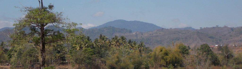
Author name: Dan

Phou Sao

Facts Elevation: 2,585 m (8,481 ft) Prominence: 1,365 m Ribu category:  Tinggi Sedang Region:  Northern Lao Coordinates: 19.1558, 103.4667 Rating: World Ribus ID: 68559 Bagging It! Currently unknown. Practicalities Getting there: Currently unknown. Permits: Currently unknown. Water sources: Currently unknown. Local Average Monthly Rainfall (in Luang Prabang) Location   Click on the blue arrow (top right) to […]

Phou Sao Read More »

Phou Sansoum

Facts Elevation: 2,625 m (8,612 ft) Prominence: 1,490 m Ribu category:  Tinggi Sedang Region:  Northern Lao Coordinates: 19.1283, 103.8055 Rating: World Ribus ID: 68542 Bagging It! Currently unknown, but a track is shown in the forest just 1.5km to the north-west of the peak. Practicalities Getting there: Currently unknown. Permits: Currently unknown. Water sources: Currently unknown. Local

Phou Sansoum Read More »

Phou Bia

Facts Elevation: 2,830 m (9,285 ft) Prominence: 2,079 m Ribu category:  Tinggi Sedang Region: Northern Lao Coordinates: 18.9808, 103.1517 Rating: Other names: ພູເບັ້ຍ  World Ribus ID: 68505 Bagging It! Phou Bia is the highest mountain in Lao and the Annamite Range, rising on the southern edge of the Xiangkhoang Plateau in Xaisomboun Province. Despite its lofty

Phou Bia Read More »

Phu Soi Dao

Facts Elevation: 2,120 m (6,955 ft) Prominence: 1,686 m Ribu category:  Tinggi Sedang Region:  Northern Lao /  Northern Thailand Coordinates: 17.7312, 101.0072 Rating: Other names: ภูสอยดาว World Ribus ID: 68521 Bagging It! Phu Soi Dao is the highest peak of the Luang Prabang Range straddling the Thailand–Lao border, and one of the region’s most prominent mountains. The Thai side is protected within

Phu Soi Dao Read More »

Olet Takan

OLET TAKAN

Olet Takan is the most prominent peak in the hilly interior of the island of Sumbawa south of the town of Sumbawa Besar. It is not yet popular with hikers and finding anyone who has been to the top remains difficult. However, the area around Ropang is incredibly scenic and it makes a great day out from Sumbawa Besar.

Olet Takan Read More »

Bukit Pagon

Facts Elevation: 1,875 m (6,152 ft) Prominence: 955 m Peak category:  Spesial Region:  Sarawak Division: Bahagian Limbang Coordinates: 4.2932, 115.3223 Rating: Bagging It! Bukit Pagon (‘Pagon Hill’) is moderately famous for being the highest mountain in the small country of Brunei. In recent years it has been climbed on several occasions, always from the Malaysian (Sarawak) side

Bukit Pagon Read More »

Gunung Ulu Titi Basah

Facts   Elevation: 1,533 m (5,030 ft) Prominence: 1,059 m Ribu category:  Kurang Tinggi Region:  Peninsular Malaysia /  Southern Thailand Malaysian state: Perak Coordinates: 5.7998, 101.3166 Rating: Other names: เขาฮูลูติติปาซา in Thai World Ribus ID: 68685 Bagging It! This obscure mountain lies on or very close to the border with Thailand and is the highest summit of the

Gunung Ulu Titi Basah Read More »

Gunung Gawalise

GAWALISE

Gunung Gawalise is Palu’s iconic mountain and gives its name to a local sports stadium. Given that it is only about 20 minutes from a major airport with direct flights to Jakarta, you would expect that Gawalise must be one of Indonesia’s most accessible mountains. The views over Palu valley, bay and city are magnificent from its slopes, but considerable access issues remain at the foot of the mountain.

Gunung Gawalise Read More »

Gunung Manukoko

Facts Elevation: 995 m (3,264 ft) Prominence: 995 m Peak category:  Spesial Region:  Timor-Leste (East Timor) Island: Atauro Coordinates: -8.2700, 125.5758 Rating: World Ribus ID: 69225 Photos Bagging It! Gunung Manucoco (995 m), sometimes spelt ‘Manukoko’ (probably the Indonesian spelling), is the highest point on the island of Atauro (pronounced ‘ata-uro’) and located on its southern-most corner.

Gunung Manukoko Read More »

Gunung Masurai

MASURAI

This Ribu is the highest peak in Jambi province (assuming you count Kerinci as in West Sumatra) and has two lovely highland lakes – Lake Kumbang and Lake Mabuk – which are of a smilar size to each other and were presumably once active volcanic craters. The normal starting point is Sungai Lalang (1,365m) – a 3 hour drive from Bangko on the Trans-Sumatran highway or just over 4 hours from Muara Bungo airport.

Gunung Masurai Read More »

Scroll to Top