
Facts
- Elevation: 1,687 m (5,535 ft)
- Prominence: 527 m
- Peak category:
 Spesial
 - Region:
 Peninsular Malaysia
 - Malaysian state: on the border of Selangor and Pahang
- Range: Banjaran Titiwangsa / Main Range
- Coordinates: 3.5496, 101.8058
- Rating:


 (4 votes) Add your rating
 Loading...
Photos
")
")
")
")
")
")
")
")
")
")
")
")
")
")
")
")
")
")
")
")
Bagging It!
Gunung Rajah is part of the same section of the Titiwangsa mountains – or Main Range – as Genting Highland’s Ulu Kali and the fascinating old hill station of Bukit Kutu near Kuala Kubu Bharu. Yet it is considerably more remote than either of them and is probably the remotest mountaintop within a short distance from Kuala Lumpur. One of the best things about Gunung Rajah is that in clear weather the views from the summit are fantastic.
It can be climbed from either the Pahang side (south-east approach) or the Selangor side (north-west). Both have their advantanges and disadvantages. The newer Selangor route is harder, shorter, easier to reach from Kuala Lumpur and with less significant river crossings but more leeches. The traditional Pahang route is a little easier, longer, more time-consuming to reach from Kuala Lumpur and with some more serious rivers needing to be crossed yet less leeches reported. In 2024, the Selangor route is more popular, though it used to be the other way round.
From Chamang near Bentong town, Pahang:
This is the traditional route up to the peak from a large car park near Chamang waterfall where there is a toilet and shower block. 4 kilometres along a logging road beyond the car park and via an Orang Asli village there is a large green arch (400m) displaying the mountain name at the proper trailhead where there is a forestry ranger to check permits. Some hiking groups take a 4WD to cover these first 4 kilometres. The trail leads via Sungai Terling, Resam (550m), Kuala Sungai Terling / Sungai Y where you need to cross the river, then several more river crossings on the way to Kem Lata Naning (780m), Rescue Point, Kem Batu Hijau / Lata Hijau, Permatang Guntong (false peak), a very steep roped rock-climbing section up a rockface (1,480m) before Last Water Point (only for emergency use), and the finally the summit. It takes around 6-7 hours up and 5-6 hours down and is just under 14 kilometres one-way. Most hiking groups camp at the pleasant Lata Naning waterfall as a dayhike is very tough and exhausting. The river crossings need extreme care and can be impassable after heavy rain, so be prepared. There are not too many leeches on this trail, rather surprisingly.
From Kampung Pertak near Kuala Kubu Bharu town, Selangor:
This route is shorter (11.5km one-way) but not that much quicker than the Chamang route, if at all. However, the lack of multiple major river crossings means it can be done more safely as a dayhike than the other route. The biggest challenge on the route is probably the amount of downs on the way up, and the ups on the way back down. It is a very undulating ridge and this means a total elevation gain of well over 2000 metres in a single outing.
You should set off before sunrise if you want to have a good chance of a view at the summit as it often clouds over by lunchtime. The trail shares the same starting point as Bukit Kutu. From the Pertak trailhead (278m) where there is plenty of space to park vehicles alongside the Pertak river, the trail leads via a bridge (283m) over a pleasant river, then a damaged and collapsed bridge (283m) which just about makes it possible to get across safely except after incredibly wet weather (the same kind of conditions which must have led to its collapse) and then an unmarked trail junction (309m) for Gunung Rajah on the left. This is followed by another junction (386m) which leads towards Lata Medang waterfall. After several stream crossings (424m, 486m, 601m and 644m), the trail then arrives at Kem BMW (661m).
Kem BMW is the finest large camping area near a pleasant river, and all camp spots higher up are smaller and have less readily available water sources. However, given Kem BMW is not very far into the hike it is barely worth brining lots of camping equipment when you are so close to the trailhead. The BMW name comes from a hiker in a group that opened the trail who had recently bought a new car. Not exactly the most poetic of names but better and more memorable than ‘checkpoint x’.
After Kem BMW you need to take a right or else you will end up at Lata Makau. The trail then crosses a river (712m) before reaching Kem Botol (817m) where there is no water source but an empty glass bottle tied to a tree. Perhaps there ought to be a BMW tied to a tree at the previous camp. Next up is Kem Renoma (974m), where the vegetation is less dense and some views are possible. The trail then drops down to Waterpoint (911m) before ascending again via Kem R and R (1,010m) and a minor peak (1,289m) to the ridge junction (1,342m) which is the top ridge.
From this point there is a fair bit of up and down. Look out for several sections of metal pipe on the path that apparently date from the colonial era. It is not known what they were used for, or if the project they were part of was simply abandoned. But it’s a remote part of forest in which to discard numerous metal pipes.
That said, around three kilometres north of Gunung Rajah is Bukit Ulu Bakau (1,347m), a tin mine was in operation during the colonial era, at least during the 1910s, and at least three mine tunnels can still be seen today. Perhaps the two projects were linked.
Kem Asyur (1,273m) is next. From this point you may be lucky to spot corybas, the tiny helmet orchids hiding in the moss. False Peak (1,592m) is a lovely collection of mossy boulders but is actually a False False Peak, since it is not the highest point of anything, but rather still on the slopes. You can detect a change in the atmosphere here, with different vegetation and a feeling that you are nearing the top of something significant. The most challenging and dangerous section of trail follows, with a steep roped rock section complete with a single aluminium ladder (1,575m) before finally reaching the top, which is just beyond the trail junction (1,683m) with the trail up from the Pahang side. If you have made it to the top in less than 7 hours then you have done exceedingly well.
There are some spots at the top where camping would be possible, but after incidents involving hikers being struck by lightning, it is no longer recommended (or perhaps no longer allowed). In clear weather, you should be able to see Gunung Nuang to the south, Gunung Semangkok to the north and Gunung Benum to the north-east. The summit is mostly clear of tall vegetation, with a rocky outcrop of low stones being the highest point and looking rather similar to the summit of Gunung Irau, not least because they both share a similar dark red summit sign.
If you have made it up here without the village dogs from Pertak following you up then count yourself lucky. They often follow hikers up Bukit Kutu and may even follow a group Gunung Rajah, but it probably depends on how early you start, how many other hikers there are that day, where they are going and how much food they are perceived to have with them. One guide reports dogs following him up Gunung Rajah but unable to ascend the aluminium ladder. After the dogs started whining, he proceeded to carry then up the ladder, one-by-one so they could reach the true summit. Given how many hikes these Pertak dogs go on, they have probably long since forgotten about it.
Descending by the same route takes around 6 hours. It is possible to do a traverse and drop down to the Pahang side, but this requires two sets of paperwork from the different forestry departments and two separate guides (one from each state, who would presumably meet at the summit) so is rather unappealing because of the heavy bureaucracy and costs.
Bagging information by Dan Quinn (August 2024)
Trail Map

For a high quality PDF version of this and other trail maps, please download from our Trail Maps page.
Practicalities
- Getting there: Both trailheads are relatively close to KL, though Pertak is closer. Neither is well-served by public transport so a car is almost essential. For Malaysian domestic flights and flights within Southeast Asia, for example to Kuala Lumpur, we recommend Baolau.
- Guides and GPS Tracks: Want a PDF version for your phone? Looking for a guide? Need GPS tracks and waypoints? Gunung Rajah information pack can be downloaded here.
- Permits: You can register and pay for an e-Permit online from the Forestry Department of Malaysia website though you will need an official guide with you. RM10 for locals and RM30 for foreigners (in 2024).
- Water sources: On the Selangor side, the last really good water point is at 911m after Kem Renoma. On the Pahang side, Lata Naning is the best source.
- We recommend Safety Wing as travel insurance for overseas travellers and tourists hiking up to elevations not exceeding 4500 metres.
Local Average Monthly Rainfall 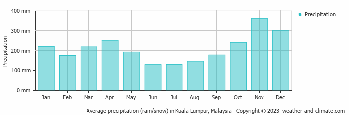
Location
Click on the blue arrow ![]() (top right) to see your current location on the map
(top right) to see your current location on the map
I did Trans RHB (Gunung Rajah & Bukit Hulu Bakau) with a group of Malaysian hikers in April 2025. It is a 27.2km effort with around 2600m of ascent. Started off after 2am and we finished around 5pm.
Excellent. Did you see the tunnels at Hulu Bakau?
Oh yes, we did. 🙂
Gunung Rajah had not been on my radar until my friend Pravin mentioned it when I showed him the list of 50 mountains that I was planning to include in the ‘Exploring Malaysia’s Mountains’ publication. When Telapak Buruk turned out to be closed, it was an opportunity to replace that mountain with Gunung Rajah.
It really is a significant mountain, and feels like an important point in the Titiwangsa Range when you near the summit. The views on all sides is something of a rarity in Peninsular Malaysia but you usually have to be up there early in the morning to enjoy those views to the fullest extent possible.
It took us 12.5 hours return, plus a short break at the top. We started at 4am. The junctions near the start after the track diverges from the Bukit Kutu trail are not obvious so the guides really are essential here. Even at 4am, there were some Orang Asli working in the forest, searching for durian to sell. We had first light up at Kem Renoma after 3 hours of hiking and were at Kem Asyur in just over another 2 hours.
It was about as much as I would want to do in a day, less because of the distance and more because of the total elevation gain due to all the ups and downs. We did the KKB route. The Orang Asli roadblock at Pertak now charge RM2 per car, still very reasonable but up from last year’s RM1. They were not out at 4am on a weekday but weekends would be a different story.
One highlight was having a flying lizard fly into my back on the way down, before flying off again and landing on a treetrunk. The tiny Corybas (miniature orchids in moss) are up here too, but need a good eye to find. Plenty of pitcher plants too.
The section just before the ladder is genuinely dangerous, with a massive drop on one side. I would not like to carry a large backpack up this section. And beyond the ladder, the scenery is gorgeous.
My Garmin GPS gave a figure as a high as 1,704m at the summit, quite a surprise as most other readings over the entire trip had fitted in quite well with published figures. Online and on signs you see Rajah listed as 1,680m, 1,683m and 1,685m. After asking for some assistance with the most recent DEM data, it turns out is probably is a bit higher than all of them but probably not as high as 1,700m. So 1,687m it is for now.
The next day on Bukit Lagong I was absolutely knackered and had to drink vast quantites of all manner of juice cartons to rejuvenate myself after the previous day’s exertions.