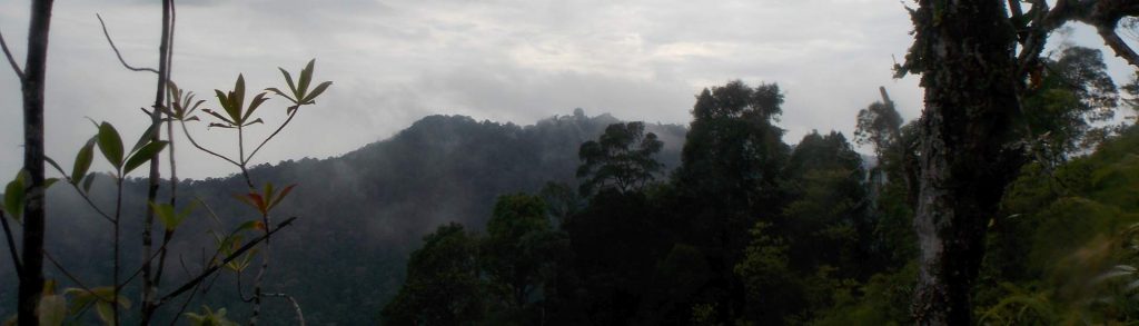
Author name: Dan

Gunung Dua Saudara

Dua Saudara is the highest mountain in the area to the east of Gunung Klabat in North Sulawesi. There are actually three main peaks that give their names to the Tangkoko-Batuangus-Dua Saudara National Park area. Tangkoko is the northeastern-most volcano on the island of Sulawesi and is home to numerous rare animal and plant species. Many foreign tourists visit the lower slopes to see the tarsiers at dusk or dawn, plus the black monkeys, numerous hornbills and cuscus.

Gunung Dua Saudara Read More »

Gunung Bawang

‘Onion Mountain’ is probably the most accessible hike of any great significance in West Kalimantan. Despite being less than 1500 metres high, the mountain has a huge amount to offer adventurous hikers including gorgeous rivers, pristine forests home to hornbills, pitcher plants, black orchids and all manner of creepy-crawlies plus stunning, panoramic views from the summit. One of the easier mountains to ‘bag’ in Borneo, Gunung Bawang remains relatively unknown to hikers outside of the province.

Gunung Bawang Read More »

Gunung Lumut

Facts Elevation: 1,236 m (4,055 ft) Prominence: 1,059 m Ribu category:  Kurang Tinggi Province:  Kalimantan Timur (East Kalimantan) Coordinates: -1.3962, 115.9903 Rating: World Ribus ID: 69191 Photos Bagging It! Gunung Lumut is listed as 1,183m high on the Bakosurtanal map but this is almost certainly an underestimate based on other, more recent sources. From Balikpapan it would

Gunung Lumut Read More »

Gunung Pugung

Facts Elevation: 1,964 m (6,444 ft) Prominence: 990 m Peak category:  Spesial Province:  Lampung Coordinates: -4.9758, 103.8600 Rating: World Ribus ID: 69228 Photos Bagging It! Unknown at present. According to the Bakosurtanal map, the summit features the triangulation pillar P.76. Practicalities Getting there: There are regular buses from Bandar Lampung (Rajabasa terminal) to Liwa (where you can

Gunung Pugung Read More »

Western Hill

WESTERN HILL

Western Hill is the highest point of the island of Penang (Pulau Pinang). Many visitors visit nearby Penang Hill, which was once a favourite colonial retreat, is easily accessible and features temples, restaurants, souvenir stalls, an owl museum and a pitcher plant garden.

Western Hill Read More »

Gunung Ulu Soh

Facts Elevation: 1,324 m (4,344 ft) Prominence: 1,090 m Ribu category:  Kurang Tinggi Region:  Peninsular Malaysia Malaysian state: Perak Coordinates: 5.0833, 101.0975 Rating: World Ribus ID: 68660 Bagging It! Gunung Ulu Soh is not a popular mountain, with just two groups known to have hiked it in recent years. One of those was in 2024. A 4WD

Gunung Ulu Soh Read More »

Foho Leolako

Facts Elevation: 1,929 m (6,329 ft) Prominence: 1,113 m Ribu category:  Kurang Tinggi Region:  Timor-Leste (East Timor) Coordinates: -8.9583, 125.2750 Rating: Other names: Leolaco World Ribus ID: 69171 Bagging It! We have very little information on this mountain at present.

Foho Leolako Read More »

Foho Leohitu

Facts Elevation: 1,942 m (6,371 ft) Prominence: 1,195 m Ribu category:  Kurang Tinggi Region:  Timor-Leste (East Timor) Coordinates: -9.0858, 125.2308 Rating: Other names: Leohito, Luhito, Lolo Tapi. World Ribus ID: 69145 Bagging It! We have very little information on this mountain at present. There is an Indonesian Bakosurtanal map covering the area which lists the peak as

Foho Leohitu Read More »

Foho Kabalaki

Facts Elevation: 2,459 m (8,068 ft) Prominence: 1,014 m Ribu category:  Tinggi Sedang Region:  Timor-Leste (East Timor) Coordinates: -8.9525, 125.5983 Rating: Other names: Also spelt ‘Cabalaki’ World Ribus ID: 69215 Bagging It! We have very little information on this mountain at present but Hatobuilico guides tell us it can be hiked in a day. Practicalities Getting there:

Foho Kabalaki Read More »

Scroll to Top