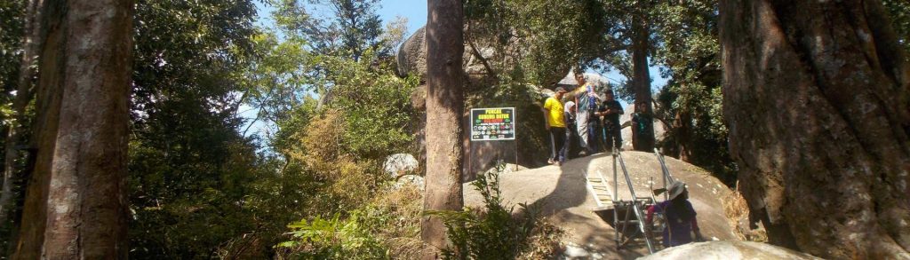
Author name: Dan

Gunung Abong-Abong

Facts Elevation: 2,985 m (9,793 ft) Prominence: 1,104 m Ribu category: Tinggi Sedang Province:  Nanggroe Aceh Darussalam Coordinates: 4.2416, 96.7950 Rating: World Ribus ID: 69175 Bagging It! The US Army map gives two elevation figures for this mountain – 2961m and 2985m. The Metalik group of hikers in Aceh reached Point 2961m (shown as being south […]

Gunung Abong-Abong Read More »

Gunung Hijau

Facts Elevation: 2,274 m (7,461 ft) Prominence: 1,370 m Ribu category:  Tinggi Sedang Province:  Sumatera Barat (West Sumatra) Coordinates: 0.1425, 100.2417 Rating: World Ribus ID: 69100 Bagging It! We currently know very little about this peak – please contact us if you can provide any information. The US Army map actually lists two peaks on this long

Gunung Hijau Read More »

Osu Nando’oto

Facts Elevation: 2,421 m (7,943 ft) Prominence: 1,235 m Ribu category:  Tinggi Sedang Province:  Sulawesi Tenggara (Southeast Sulawesi) Coordinates: -3.3861, 121.5577 Rating: Other names: Previously listed as “Osu Nondoto”. World Ribus ID: 69130 Bagging It! See the comment below this post to read a little on the pioneering 11-day expedition to the top of this remote mountain

Osu Nando’oto Read More »

Gunung Telomoyo

Facts Elevation: 1,894 m (6,214 ft) Prominence: 617 m Peak category:  Spesial Province:  Jawa Tengah (Central Java) Coordinates: -7.3610, 110.3999 Rating: Photos Bagging It! This small mountain lies near Salatiga, to the north of the huge Merbabu mountain. It is very easy to ‘climb’ because there is a road to the communications towers at the summit. Apparently

Gunung Telomoyo Read More »

Gunung Pulosari

This peak is the most popular climb in Banten. It is less prominent and less high than nearby Gunung Karang but is far more interesting as it features an impressive crater. There are great views from the summit ridge and it is a very easy hike – if you start early enough you can be back down in time for lunch. It is perfect as a last-minute day trip from Jakarta and takes just over two hours to reach by car.

Gunung Pulosari Read More »

Gunung Ijen-Merapi

Facts Elevation: 2,803 m (9,196 ft) Prominence: 1,218 m Ribu category:  Tinggi Sedang Province:  Jawa Timur (East Java) Coordinates: -8.0627, 114.2620 Rating: Eruptions: Ijen 1796, 1817, 1917, 1936, 1952, 1993-94, 1999, 2002 World Ribus ID: 69139 Photos Bagging It! The Merapi-Ijen volcano complex lies within the much larger Ijen caldera on the eastern-most tip of Java overlooking Banyuwangi, the point

Gunung Ijen-Merapi Read More »

Gunung Singgalang

SINGGALANG

This dormant peak is close to the pleasant tourist town of Bukittinggi and the huge Lake Maninjau. Along with neighbouring Gunung Marapi, it dominates the landscape south of the town. Singgalang is a twin volcano with the lower yet volcanically active Gunung Tandikat (2,438 m) and could be considered as Sumatra’s version of Gede-Pangrango.

Gunung Singgalang Read More »

Keli Lepembusu

Facts Elevation: 1,754 m (5,755 ft) Prominence: 1,250 m Ribu category:  Kurang Tinggi Province:  Nusa Tenggara Timur Island: Flores Coordinates: -8.6727, 121.8111 Rating: World Ribus ID: 69126 Photos Bagging It! Keli Lepembusu is a few metres higher than nearby Gunung Kelimutu, whose famous three crater lakes of different colours are one of the main tourist attraction on

Keli Lepembusu Read More »

Gunung Rembau

REMBAU

Gunung Rembau is the highest part of the large mountain range southeast of KL and Seremban. This hilly area stretches tens of kilometres from Seremban all the way down to Tampin in the south. The most popular hikes in the area are the easy Gunung Angsi (825m) in the north and Gunung Datuk (705m) in the south.

Gunung Rembau Read More »

Scroll to Top