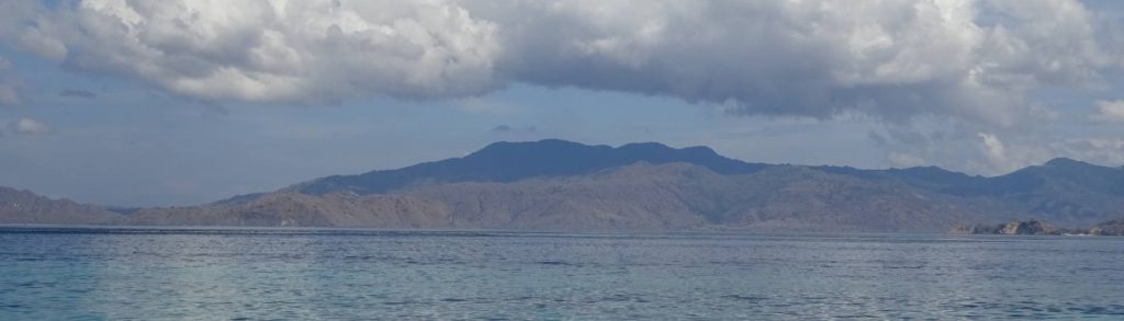
Spesial

Gunung Semangkok

Facts Elevation: 1,825 m (5,988 ft) Prominence: 623 m Peak category:  Spesial Region:  Peninsular Malaysia Malaysian state: on the border of Selangor and Pahang Range: Banjaran Titiwangsa / Main Range Coordinates: 3.7375, 101.6512 Rating: Other names: Sometimes spelt ‘Semangkuk’ or ‘Semangko’. Photos Bagging It! Despite Semangkok’s relatively modest elevation, and the relatively high starting point (approximately 1,312m), this

Gunung Semangkok Read More »

Colo

COLO

Gunung Colo on Pulau Una-una is Central Sulawesi’s only active volcano. It is perhaps the most isolated of the Togean Islands group in the Gulf of Tomini, but access is fairly easy given how popular the islands are with divers. The volcano has only erupted three times in recent history, but the most recent one in 1983 devastated the island, permanently altered the shape of its rivers, and forced all residents to evacuate.

Colo Read More »

Bukit Jempol

Bukit Jempol is one of the best-known landmarks in Sumatra due to its steep and impressive summit cliffs and its location close to the town of Lahat. It is so well known and striking, in fact, that it has at least three names: Bukit Jempol (‘thumb hill’), Bukit Telunjuk (‘index finger hill’), and Bukit Serelo. The trek to the base of the summit cliffs is fairly easy and it makes a pleasant half-day hike.

Bukit Jempol Read More »

Gunung Jantan

Facts Photos Bagging It! Although this peak is a lowly 439m high and the hike itself takes just 3 hours in total, it is a worthwhile excursion for people living in Batam and Singapore. In clear weather you can see the tip of the Malaysian peninsula and the city of Singapore from the tower at

Gunung Jantan Read More »

Gunung Ara

Facts Elevation: 824 m (2,703 ft) Prominence: 824 m Peak category:  Spesial Province:  Nusa Tenggara Timur Island: Komodo Coordinates: -8.5651, 119.4475 Rating: Photos Bagging It! Gunung Ara is the highest point on Komodo Island, which like neighbouring Rinca Island lies between the larger islands of Sumbawa and Flores and is famously home to the Komodo dragon. Komodo

Gunung Ara Read More »

Gunung Bawakaraeng

Bawakaraeng is the most popular hike in South Sulawesi, because of both its proximity to Makassar and also its considerable height. The trail itself is in excellent condition although, since the enormous October 2004 landslide that took a large part of the mountainside down with it, the hike is a considerable 7-8 hours from the trailhead to the summit. The likelihood is that you will meet plenty of other hikers, especially on weekends, and perhaps even Tata Rasyid, the guardian of the mountain who climbs on a regular basis for the frequent traditional religious celebrations that take place up the mountain.

Gunung Bawakaraeng Read More »

Gunung Lokon

LOKON

Lokon is a very active twin volcano with the adjacent Empung and is located close to the pleasantly cool town of Tomohon, which is surrounded by agricultural land. All recent eruptions have originated from the Tompaluan crater which lies in the saddle between the two peaks – when most people say they climbed Lokon they mean they visited the crater and most guides will think you only want to go to the crater.

Gunung Lokon Read More »

Gunung Kemiri

Facts Elevation: 3,317 m (10,883 ft) Prominence: 851 m Peak category:  Spesial Province:  Nanggroe Aceh Darussalam Coordinates: 3.7477, 97.4791 Rating: Other names: Written as ‘Kemili’ on the Bakosurtanal map. Photos Bagging It! Do not attempt to climb any of the mountains in Aceh province that are over 3,000 meters if you do not have extra time on

Gunung Kemiri Read More »

Scroll to Top