
Facts
- Elevation: 620 m (2,034 ft)
- Prominence: 519 m
- Peak category:
 Spesial
 - Region:
 Peninsular Malaysia
 - Malaysian state: Kedah
- Coordinates: 5.6703, 100.8939
- Rating:


 (4 votes) Add your rating
 Loading...
Photos


")
")
")
")
")
")
")
")
")
")
Bagging It!
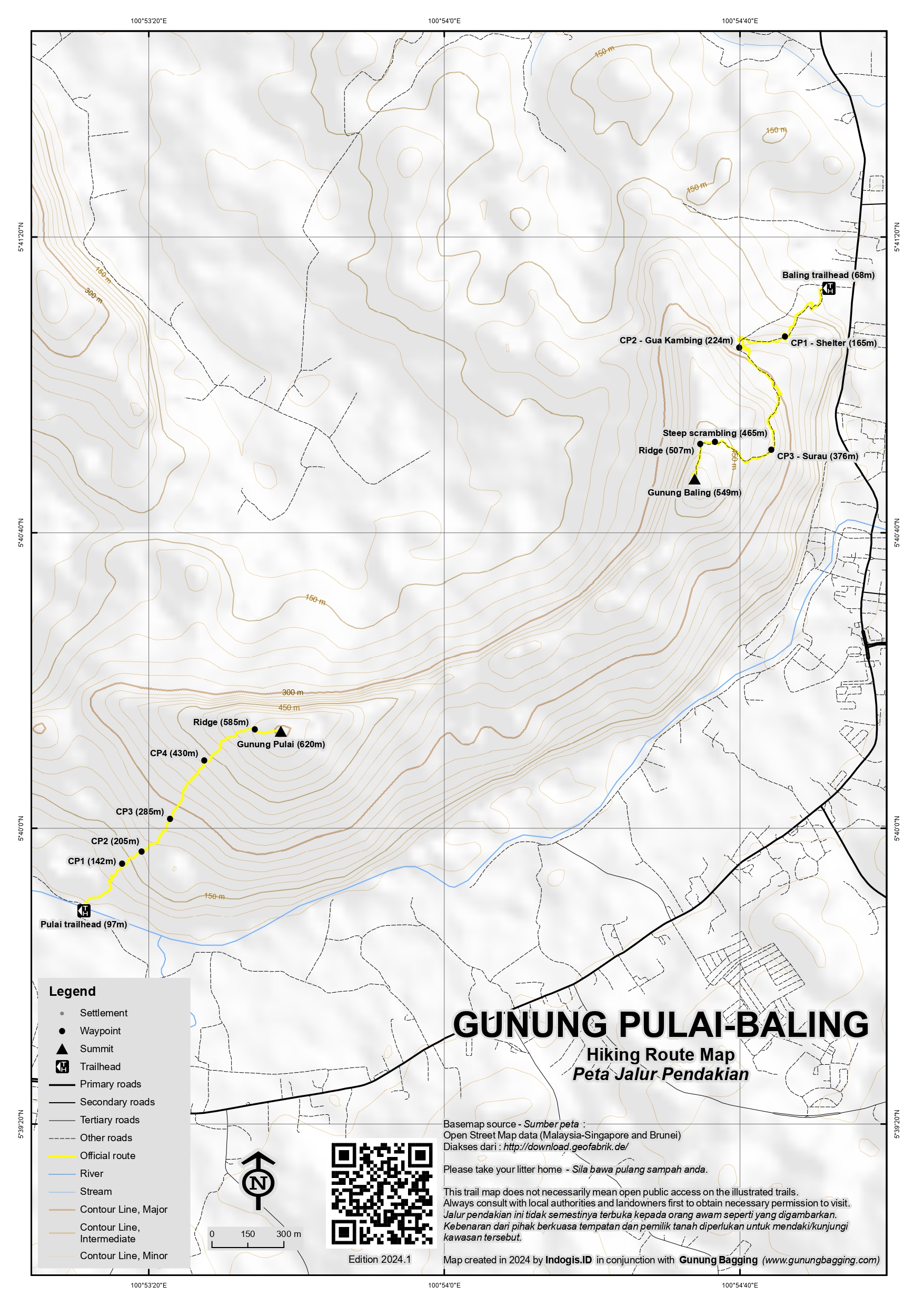
Not to be confused with Gunung Pulai in southern Johor near Singapore, this mountain in northern Peninsular Malaysia near the town of Baling has two separate trails to two different peaks – Gunung Pulai (620m) at the western end of the rocky little limestone range and Gunung Baling (546m) at the eastern end.
Both are brilliant viewpoints, and sunrise is often watched from the summit of Gunung Pulai after a hike up in the early hours of the morning. Despite only being three kilometres apart, each peak has its own distinct atmosphere so much so that to get a deep understanding of the mini-range in full it is recommended to hike both of them. There is a surprising amount of wildlife here, with hornbills flapping their wings above the forest and the distant call of siamangs relatively common. Both treks are stiflingly hot but as the Gunung Baling office does not open until 8am it makes sense to tackle Gunung Pulai first if you fancy bagging both the same day.
Gunung Pulai
Gunung Pulai is both the higher and the harder of the two, requiring 2 hours to the summit up near vertical rock and a similar amount back down. The original trailhead involved crossing a bridge over the river from the south. This was washed away a few years ago so access is via the minor roads from the west on the north side of the river. Allow around 4-5 hours for a round trip, including a little time at the top for photographs. A local guide essential, as is a forestry permit arranged in advance via your guide.
The new trailhead (97m) is simply a rustic gate on the north side of the river where there is enough space to park a few vehicles. Once through the gate and into the field, there is a collection of stones laid out in rows. These are ancient grave markers. A cave lies a short distant away in the cliffs. It may well be that you cannot see these features on the way up as if you want to enjoy sunrise then you will need to start your hike before 5am with a headlamp. Be aware that trekking poles are of little use on this trail as you need both hands free to use ropes and pull yourself up steep sections of rock. For much of the way it is a scramble rather than a walk and there are many places where a fall would lead to serious injury as there are many holes between the sharp rocks. So do take extra special care on this trail. There are four Checkpoint areas (at 142m, 205m, 285m and 430m) with enough level ground for a proper rest or even a quick snooze before proceeding to the top.
Suddenly you will find yourself on the summit ridge (585m), with the lights of villages and towns stretching out below you. Follow the ridge up to the true peak which has a crumpled green summit sign. There is barely any space to pitch a tent here and the terrain is so bouldery that it would be uncomfortable anyway. The view along the ridge to Gunung Baling is exceptional when clear, but you may be greeted with hazy conditions. Take real care on the ridge as the drop on the northern side is vertical. The higher mountain lying to the south with a telecommunications tower near the top is Bukit Palong. The highest point of Bukit Palong is over 900 metres high and the border of Kedah and Perak runs across it.
Gunung Baling
At 546 metres (with a prominence of approximately 198 metres), Gunung Baling is a bit shorter than Gunung Pulai, requiring under 2 hours up and less for the descent. It is quite a different experience, as there is a dedicated parking area with a ticket office and toilets and apparently no need for a guide. You can use trekking poles on this hike though there are one or two very short sections where you need to scramble. The ticket office opens at 8am and the latest time you ought to start your ascent is 10:30am. This rule is in place for safety reasons, presumably so that hikers do not end up stuck at the top in a common afternoon downpour.
From the parking area (68m), follow the wide track as it leads you up steps and past a small, modern shelter. This is Checkpoint 1 (165m). A bit further along, the trail leads rather closely beneath a cliff face. Before long you are at Checkpoint 2 (224m), which is the very scenic Gua Kambing (‘goat cave’). Steps continue up beyond here to the Surau or prayer area. This is Checkpoint 3 (376m). Beyond the third checkpoint there are a couple of trickier sections of trail (465m), including a wooden ladder to help you up through a narrow hole in the rocks. Once through this, you are very close to the summit ridge (507m).
The saddest thing about this trek is the noise from the quarry which is in operation at the northern end of the ridge. Not only has the mountain been scarred by such operations but there is also significant noise pollution which really detracts from the hike. Once along the rocky ridge and at the true summit, there are some great views especially back along to Gunung Pulai. Behind the usual summit signs is some rather attractive yet dense bamboo growing on top.
Bagging information by Dan Quinn (August 2024)
Trail Map
For a high quality PDF version of this and other trail maps, please download from our Trail Maps page.
Practicalities
- Getting there: For Malaysian domestic flights and flights within Southeast Asia, for example to Kuala Lumpur, we recommend Baolau. Both easily accessible from Penang, with Penang being the closest major airport.
- Guides and GPS Tracks: Want a PDF version for your phone? Looking for a guide? Need GPS tracks and waypoints? Gunung Pulai-Baling information pack can be downloaded here.
- Permits: For Gunung Pulai, a guide is essential, along with a forestry permit. For Gunung Baling, foreigners pay RM30 for a ticket at the office and Malaysians pay RM10.
- Water sources: Not available on either trail – be sure to take sufficient bottled water with you.
- We recommend Safety Wing as travel insurance for overseas travellers and tourists hiking up to elevations not exceeding 4500 metres.
Local Average Monthly Rainfall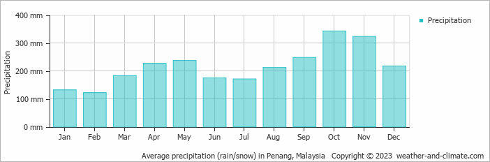
Location
Click on the blue arrow ![]() (top right) to see your current location on the map
(top right) to see your current location on the map
After our Chamah trip was cancelled, we decided to head over to the west to visit a couple of peaks in Kedah. I should have done this one but i ended up waiting in the car, fed up after getting no sleep preparing for the ill-fated Chamah trek. My friends managed it in 3 hours return. Finding the right starting point is key as the bridge over the river has been washed away. There are a few plastic bottles at the starting point (sadly) but no official sign. They saw some unusual monkeys near the top and had no issues hiking during the day (locals apparently tend to do this trek in time for sunrise). I’ll be back to do it myself next year along with the lower Gunung Baling at the eastern end of the ridge.