
Facts
- Elevation: 1,312 m (4,304 ft)
- Prominence: 1,065 m
- Ribu category:
 Kurang Tinggi
 - Region:
 Sabah
Sabah - Division: Bahagian Tawau
- Coordinates: 4.4980, 117.9282
- Rating:

 (2 votes) Add your rating
 Loading...
 - World Ribus ID: 69187
Photos


Bagging It!
Gunung Magdalena is the tallest peak in the range near the town of Tawau which forms the bulk of the excellent Tawau Hills Park, established in 1979 as Sabah’s southernmost forest reserve. Although not particularly high, Gunung Magdalena is one of Sabah’s most topographically prominent peaks. There is also a fabulous hostel to stay in on the slopes of the second-highest peak, Gunung Lucia (1,201m). Some adventurous hikers include the third-highest too, Gunung Maria.
Magdalena is the most distant destination on the trail, lying 17 kilometres from Taman Bukit Tawau HQ. Fast hikers could complete the trek to both peaks in 2 days but the best itinerary is spread over 3 days so that Lintagu Hostel can be made use of. A guide from the Park is essential. Leech socks or ‘stockings’ as they are known locally are advisable here but mosquitoes do not present a major problem.
Below is a description of a 3 day trip, taking in the two highest peaks. Note that there is accommodation available at Park HQ but it is best to avoid weekends due to how busy it gets.
Day 1 (4 hours):
Starting at Tawau Hills Park HQ (260m) after registering, the first section of trail is very well-defined as it is used on a daily basis by tourists coming to look for wildlife here. Less than 500 metres along the trail is a manned signing in booth after which the trail leads over some minor bridges alongside the river on the right. A well-signposted junction on the left (284m) points the way to what used to be billed as the tallest living tropical tree in the world, a yellow meranti (Shorea faguetiana) at 88.32 metres, until an even taller example of the same species was discovered in 2018 – also in Sabah – in the Danum Valley Conservation Area, measuring 100.8 metres and known as ‘Menara’ (Tower’).
Just over another kilometre along the main trail is a very important junction (293m), with an old bridge leading over to the river on the right. This is the way to the hot springs and beyond to Gunung Maria. Those hikers who aim to reach all three peaks – Magdalena, Lucia and Maria usually hike Maria last and descend this way via the hot springs. The ‘three sisters’ were apparently the names of the daughters of a Westerner who lived and worked locally many decades ago, presumably before the peaks had any widely-used local names.
Continuing along the main trail, a river crossing (299m) is soon necessary, but a rope is provided to help hikers get across during periods when the water level is high. A short distance beyond the river crossing is another important trail junction (332m), with a left turn leading Bukit Gelas waterfall and a right turn leading upwards towards Gunung Magdalena and Lucia. After this point you are not likely to see any other day-trippers searching for wildlife as the trail is almost-exclusively used by mountain hikers. So this is where the proper trek begins and where the trail gets much steeper.
A bit further up the mountainside are some wildlife camera warning signs (577m) so please be careful to avoid disturbing them. The target of the cameras is the Clouded Leopard (‘Harimau Dahan’). You are now entering a part of the forest known as ‘Kerangas Forest’ and supporting high species diversity, the word being taken from the Iban language and meaning ‘infertile soils in which rice cannot grow’. It is also known as ‘heath forest’. The next important point on the trail is Pondok Casuarina (631m), a simple shelter with a water source and basic toilet facilities with a water tank.
Not too long afterwards is a second shelter, Pondok Pandanus (714m) which is very similar to the first. A tiny stream (815m) is crossed just over a kilometre beyond this second shelter and then – after a total of around 4 hours from Park HQ – the wonderful Hostel Lintagu (862m) is reached. This really is a hostel, a spacious long wooden building with several rooms of bunk beds, shared bathrooms, electricity after dark for lighting from the solar panels, a communal eating area and simple cooking facilities. If you avoid weekends you may have it to yourself except for the staff who look after it several days per week, including cutting the lawn surrounding it. The hostel has several names including Hostel 10.55KM (due to its position on the trail), and Hostel Gunung Lucia as it is on the slopes of Gunung Lucia.
Assuming you started your hike quite early, you should have most of the afternoon to relax, do some birdwatching and enjoy listening to the insects in the nearby forest. You may even be treated to a gorgeous sunet or a visit by a rarer animal or two. There’s a jambu tree growing by the hostel so you may even be in luck with a fruit or two. It feels almost luxurious!
Day 2 (8-10 hours):
Day 2 is the bigger day, in between the two shorter treks on Days 1 and 3. Most hikers here will aim to reach the summits of both Gunung Magdalena and the second-highest peak in Tawau Hills Park, Gunung Lucia. An early start is advised.
From Hostel Lintagu, the trail leads up via the Helipad (904m), a grassy open area which was originally used for depositing the materials to construct the hostel, a junction on the left for a waterfall (917m), and eventually Pondok Bumburing (1,137m) which lies just a few metres away from the trail junction for Gunung Magdalena (left) and Gunung Lucia (right). Although Gunung Lucia is only 370 metres beyond the junction, most guides will advise you to bag Gunung Magdalena first and then do Gunung Lucia on your return. It makes sense to try to reach the most distant location first, but given that views are usually best earlier in the morning and partial views are indeed possible from the top of Lucia, unlike Magdalena, there is also an argument for heading up Lucia first if the weather is pleasant.
Assuming you are going for Magdalena first, just over 4 kilometres away, this junction marks the start of a slightly frustrating descent to a river crossing and camp spot (827m) just before another shelter named Pondok Liposu, which lies at the lowest part of the col here. Having lost 300 metres of elevation can be quite mentally draining when you are hoping to reach a higher point, especially when you know you have to return the same way later on!
Actually, the final ascent from Pondok Liposu up to the summit ridge of Magdalena is fairly straightforward. A repeater (1,253m) is reached shortly before the true summit which is a boulder with a couple of summit signs on the top. The boulder is easy to get onto, given the forest vegetation, but offers no views, also due to the forest vegetation. It should have taken around 4 hours to reach this point from Hostel Lintagu, and although going down is usually faster you will probably need another 4 to get back to the hostel with a quick side diversion to bag Gunung Lucia.
Once you are back at the Magdalena-Lucia junction you may want a quick rest at the nearby Pondok Bumburing before the final push up onto the top of Lucia. It isn’t too difficult, and one spectacularly-large boulder (1,163m) makes it very scenic. The summit of Gunung Lucia (1,201m) is a small opening with summit signs and a metal beirut.
You may see a narrow path leading off on the other side of the summit of Lucia. This is the trail over to the third-highest peak, Gunung Maria (1,067m or 1,083m or 1,096m, depending on sources). But if you are intent on hiking Maria too then it will not make sense to return over Lucia to the hostel and you would most likely continue down the other side of Maria and drop down to the hot springs before reaching the trail junction near the bridge not too far from the start of the trail at Park HQ. And this would be a lot to accomplish on Day 2 before dark, especially after having been up Magdalena and Maria first.
Of the three peaks – Magdalena, Lucia and Maria – it is Maria that is thought to have been the most active in pre-historic times and given the hot springs at its base clearly has geothermal potential. Even looking at the contours on a map it is clear that the mountain is volcanic in origins, appearing more in shape like, for example, a volcanic mountain from Indonesia’s Sumbawa island.
After enjoying a break at the top of Lucia, most hikers return to the lovely Hostel Lintagu for a second night before an easy third day.
Day 3 (3-4 hours):
Day 3 is simply Day 1 in reverse. Descend back to Tawau Hills Park HQ, have a shower, and then perhaps have a nice lunch at the canteen (‘Kantin Begonia’).
Bagging report by Dan Quinn (August 2023)
Trail Map

For a high quality PDF version of this and other trail maps, please download from our Trail Maps page.
Practicalities
- Getting there: For Malaysian domestic flights and flights within Southeast Asia, for example to Kota Kinabalu or Kuching, we recommend Baolau. The closest town is Tawau which has an airport and regular flights to and from Kuala Lumpur, Kota Kinabalu and Sandakan. From the airport to Tawau Hills Park takes about 1 hour by car or taxi (or 30 minutes from Tawau itself). Public transport is poor or non-existent. There is also an express boat from Tarakan (Indonesia) to Tawau 3 or 4 times a week taking around 4-5 hours. In 2022, it leaves at 11am and costs Rp500,000 one-way.
- Guides and GPS Tracks: Want a PDF version for your phone? Looking for a guide? Need GPS tracks and waypoints? Gunung Magdalena information pack can be downloaded here.
- Permits: RM6 conservation fee for Malaysians (Rm20 for foreigners), climbing fee of RM25 for Malaysians per peak (RM50 per peak for foreigners), and guide fee of RM150 per day. The excellent Lintagu hostel is a very reasonably-priced RM20 per night. The Taman Bukit Tawau office is open at 8am until 4pm.
- Water sources: Several places along the trail with piped water but if possible boil before use. The last water point is Pondok Liposu.
- We recommend Safety Wing as travel insurance for overseas travellers and tourists hiking up to elevations not exceeding 4500 metres.
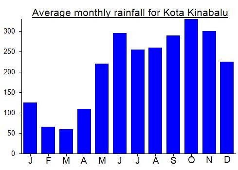
Local Average Monthly Rainfall (mm):
Location
Click on the blue arrow ![]() (top right) to see your current location on the map
(top right) to see your current location on the map
My hike to Magdalena and Lucia last month was a great hike. It had been on the ‘to do’ list for so long, especially being a Ribu (1000 metres of prominence). Tawau itself was very Indonesian, with loads of motorbikes, quite unlike any other Malaysian city, and not surprising as it is so close to the border with Indonesia.
Tawau Hills Park, or Taman Bukit Tawau, is excellent and feels well-managed from the moment you arrive. Great information boards. Even better, the canteen or small cafe is excellent. I sorted out the paperwork for the Magdalena and Lucia trek the day before, after finishing the short wander up Bombalai Hill. For me as a single foreigner hiker it came to RM686 for a 3-day trek including guide, permit, 2 nights at the hostel (which really is a hostel not just a hut), secure parking for my car, and that price is what I would call reasonable, unlike Kinabalu Park where advantage is being taken of its popularity and the bookings are all via some corporation. Tawau Hills Park is a great model for how it ought to be across Malaysia, and also neighbouring countries.
At the cafe there was a group of female hikers from Sabah hoping to do all 3 peaks, the 3 sisters of Magdalena, Lucia and Maria, within 24 hours. Quite a task and one that I believe they succeeded at. Quite why you would want to put yourself through that is another question, especially as the hostel up on the mountain is so lovely!
1StopBorneo run some decent wildlife trips in this park and I think I crossed paths with the guy who does that shortly after starting the hike. The big orange sign with trail destinations on it is a little daunting with Magdalena 17 kilometres away, but the quality of the trail at this early stage is so good that you begin to wonder what the rest of it will be like. Actually, the only steep section on day 1 is between 400 and 600m elevation, and most hikers will make it to the hostel in 4 hours or so. And then it’s time to relax. My guide Aziz was watching a local football match on his phone so some SIM cards can get you a good signal up here!
There was no sunset on day 1 for us, but had a great sleep, in a room of bunk beds just to myself. Capacity at Lintagu must be 25-30 plus the lads who stay here to clean up and tidy. Electricity from solar means lights are on at dusk. The cicadas are brilliant plus frogs, to my still rather jetlagged mind asking ‘what?’ repeatedly! Also tons of hornbills, as you might expect, that sound of them in flight being like nothing else.
Day 2 was certainly tougher, not least with the descent from an elevation of around 1150m to around 820m and over several rivers and past the last pondok – Liposu (which is named after a fruit) – located between a couple of nearby streams. then the climb up Magdalena begins. Leeches are abundant here. The peak itself is a bit of an anticlimax, with no views and for me it was very humid and misty so my phone camera was steamed up a bit, same as my eyes! Only 1280m on the official sign but 1315m on GPS so the 1312m figure about right.
It took us 4 hours back to the hostel but in torrential rain at times. This included the quick 370m walk on the side trail to Lucia peak, where the path skirts round to the left of a huge boulder, before following wooden steps which have been painstakingly installed on much of the trail here. Lucia has a Beirut and a sign -1240m, so this time too high, more like 1206m on my GPS. Ultimately you could do Lucia as a dayhike from Park HQ but would be a shame not to enjoy the hostel accommodation so a 2-dayer just for Lucia. For mad baggers keen on Magdalena a 2 day option is also possible with staying at Pondok Liposu but this plan means the need for a tent or tarpaulin at least and means no hostel or protection from a lot of leeches! You could potentially stay at the hostel for one night only then continue all the way down on day 2 but it would be 11-12 hours on day 2.
We did get a sunset on day 2 at the hostel after all the rain had finally stopped.
Day 3… 3-4 hours back down to Park HQ! Easy. A great park, wildlife, trails, staff, even if Magdalena itself is really a bagger’s peak rather than a grand viewpoint. I’d put this place on any travel itinerary in Sabah for sure.
A Gunung Bagging trip to Gunung Magdalena is likely to happen 8-9th July 2023. If you are interested in joining please reply to this message ASAP or contact via the contact page. Thanks, Dan.
Hi there, I am plan on going. Is it okay to hike without A guide
Probably not. Always best to take a guide. They are reasonably priced at Taman Bukit Tawau anyway.
I’m almost certainly going to hike this in March 2020. Please get in touch if you want to join….
For a guide, call a forest ranger at the park there. Johan +60171858286 or Alfonso +60138722354. Likely to be around RM80 a day for their services.