
Facts
- Elevation: 2,825 m (9,268 ft)
- Prominence: 790 m
- Peak category:
 Spesial
 - Province:
 Sulawesi Tengah (Central Sulawesi)
 - Coordinates: -1.2401, 121.4264
- Rating:

 (2 votes) Add your rating
 Loading...
 - Other names: Also spelt ‘Katapasa’.
Photos


Bagging It!
Katopasa is the slightly lower – but much more popular – neighbour to the rarely-visited Kandela. It is climbed several times a year by student hikers from Palu and other cities in Sulawesi. The summit itself is a sharp, shapely peak and as such may be higher at 2835m or more. The mountain is home to Anoa (small cattle) and lots of pitcher plants.
Practicalities
-
- Getting there: The main road leads along the north coast of this peninsula of Sulawesi between Poso and Luwuk.
- Permits: Unknown.
- Water sources: Unknown.
Local Average Monthly Rainfall (mm): 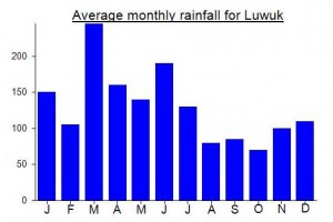
Location
Click on the blue arrow ![]() (top right) to see your current location on the map
(top right) to see your current location on the map
There is some debate regarding the correct height of both this and neighbouring Kandela. For some reason, the relevant Bakosurtanal maps suggest that Katopasa is 2865m and Kandela (Buyu Kondorung) only 2808, therefore making Katopasa the Ribu and ‘mother mountain’. Based on SRTM/Google Earth data, these Bako figures are wrong and Kandela is indeed the higher of the two, at at least 2870m…. perhaps the Bako 2808m for Kandela was a typo and should have been 2880m, but even then, quite separately, the 2865m for Katopasa seems overly optimistic. Reading from GPS devices will actually really help on these two, as the discrepancies are significant……
The first team who reach Katopasa peak is from Lalimpala FKIP UNTAD in 1996. They start from Mire Village, in Ulu Bongka district, Region Tojo Una-una, at Central Sulawesi. to reach this village, it took 6 hours from Palu by bus.
The hiking trail is divided in 11 shelters and normally take 3 days to reach the peak. there are 5 spot for getting water: shelter 1, 2, 4, 6, and 8.
before reach the Katopasa peak, we would reach 3 peaks: Lalimpala peak 2740 m (shelter 9), Tjatjo Thaha peak (shelter 10), and Karaeng peak (shelter 11).
Hey,
Are there more details available? How do I get to Mire from Palu? I do not find it while browsing the net!! and it does reconose the village of Mire on google maps
Hey guys,
Any updates on how to get to Mire ?
Hello Ojan,
I found your name in Bagging it.
Are you a guide?
I would like to visit the location and learn of the habitat of a Nepenthes plant.
Are you familiar with Nepenthes Diabolica?
I wait for your answer,
Kent
Hi Kent,
My friend text me abiut you mentioned my name here.
Finally I got you here after do search in some of mountains articles.
Yes, I am a freelance guide for Central Sulawesi, based in Palu. I saw some Nepenthes Hamata in my trip in Katopasa, and some of Nepenthes Diabolica.
I’m glad if you still have a willing to come and study about them. You can contact me via email lentik.rajawali@gmail.com or via Whatsapp 082187329211