Author name: Dan

Núi Lang Cung

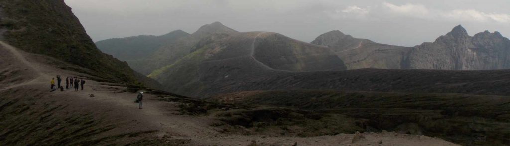
Facts Elevation: 2,913 m (9,557 ft) Prominence: 1,340 m Ribu category:  Tinggi Sedang Region:  Northern Vietnam Coordinates: 21.9024, 104.2308 Rating: World Ribus ID: 68568 Bagging It! Not a huge amount of information available but it is hiked from the south with a starting elevation of around 1,700m. Good views at the summit. Usually 2 days and 1 […]

Núi Lang Cung Read More »

Tà Chì Nhù

Facts Elevation: 2,979 m (9,774 ft) Prominence: 1,933 m Ribu category: Tinggi Sedang Region:  Northern Vietnam Coordinates: 21.5707, 104.3065 Rating: World Ribus ID: 68510 Bagging It! Apparently also known as Núi Phú Luong, this mountain is popular with local hikers and doable in one long day. The main two routes are from Xa Ho, Yen Bai

Tà Chì Nhù Read More »

Phu Si Lùng

Facts Elevation: 3,076 m (10,092 ft) Prominence: 1,732 m Ribu category:  Sangat Tinggi Region:  Northern Vietnam Coordinates: 22.6258, 102.7875 Rating: World Ribus ID: 68516 Bagging It! Unknown at present. This peak is on the border with China. Practicalities Getting there: Unknown at present. Permits: Unknown at present. Water sources: Unknown at present. Local Average Monthly Rainfall (in

Phu Si Lùng Read More »

Phu Ta Leng

Facts Elevation: 3,096 m (10,157 ft) Prominence: 1,147 m Ribu category:  Sangat Tinggi Region:  Northern Vietnam Coordinates: 22.4231, 103.6036 Rating: World Ribus ID: 68631 Bagging It! Phu Ta Leng (or Putaleng, 3,049 m) is located in Phong Tho District, Lai Châu Province, roughly 20 km northwest of Sa Pa as the crow flies, but a longer journey by

Phu Ta Leng Read More »

Fan Si Pan / Đỉnh Phan Xi Phăng

Facts Elevation: 3,147 m (10,325 ft) Prominence: 1,617 m Ribu category:  Sangat Tinggi Region: Northern Vietnam Coordinates: 22.3034, 103.7754 Rating: World Ribus ID: 68528 Bagging It! Fansipan (also spelled Phan Xi Păng) is the highest mountain in Vietnam and across all three countries of former French Indochina, thus nicknamed the “Roof of Indochina”. It lies in the

Fan Si Pan / Đỉnh Phan Xi Phăng Read More »

Gunung Ulu Sepat

Facts Elevation: 2,161 m (7,090 ft) Prominence: 775 m Peak category:  Spesial Region:  Peninsular Malaysia Malaysian state: on the border of Kelantan and Perak Range: Banjaran Titiwangsa / Main Range Coordinates: 5.1400, 101.4833 Rating: Other names: Hulu Sepat Bagging It! Like neighbouring Gunung Chamah, Gunung Ulu Sepat is rather remote and requires a well-planned itinerary and a larger

Gunung Ulu Sepat Read More »

Gunung Chamah

Facts Elevation: 2,171 m (7,123 ft) Prominence: 1,041 m Ribu category:  Tinggi Sedang Region:  Peninsular Malaysia Malaysian state: Kelantan Range: Banjaran Titiwangsa / Main Range Coordinates: 5.2275, 101.5742 Rating: World Ribus ID: 68698 Bagging It! Gunung Chamah is one of the highest and most significant mountains at the northern end of Peninsular Malaysia. It is also one

Gunung Chamah Read More »

Gunung Sebesi

This 844m high island lies in the Sunda Strait just 12km north of the Krakatau islands and is usually accessed by boat from Canti near Kalianda, Lampung. It’s a really peaceful environment and quite popular with visitors from the Sumatran mainland. Despite its calm atmosphere today, the island was devastated by the Krakatau eruption and it is hard to find a tree on the island which predates the catastrophic events of 1883. It’s a great long weekend break from Jakarta.

Gunung Sebesi Read More »

Gunung Telapak Buruk

Facts Elevation: 1,193 m (3,914 ft) Prominence: 790 m Peak category:  Spesial Region:  Peninsular Malaysia Malaysian state: Negeri Sembilan Range: Banjaran Titiwangsa / Main Range Coordinates: 2.8408, 102.0692 Rating: Other names: Also spelt ‘Telapak Burok’. Bagging It! The curiously-named Gunung Telapak Buruk, meaning Rotten Palms or Bad Palms Mountain (either hand palms or the soles of one’s

Gunung Telapak Buruk Read More »

Gunung Kelud

KELUD

This mountain is one of the most active and dangerous volcanoes in Indonesia. A large eruption in 1919 killed approximately 5,000 people and a more recent eruption in 2007-8 resulted in the crater’s pleasant blue lake being replaced with a vast lava dome. In February 2014, a huge eruption occurred two days after local people reported animals fleeing from the surrounding forests. By 2015 or so, the lake had returned, but who knows how long it will be before the next lava dome emerges to displace it once more?

Gunung Kelud Read More »

Scroll to Top