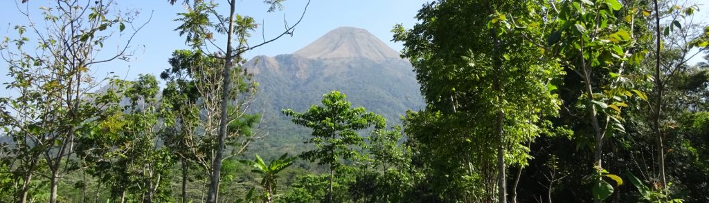
Author name: Dan

Gunung Agung

This Ribu is the highest point on the popular island of Bali and holds incredible spiritual significance for the Balinese. It is still an active volcano, and the last major eruption was in 1963. Folklore has it that when the deities made mountains for their thrones they set the highest peak in the east, the direction of honor to the Balinese. In every temple a shrine is dedicated to the spirit of Gunung Agung.

Gunung Agung Read More »

Gunung Sindoro

SINDORO

Mount Sindoro is separated from its similarly conical but slightly higher neighbour, Gunung Sumbing, by the Kledung Pass. For its size, Sindoro is an easy hike and would make a great introduction to hiking in Indonesia. From the top there are great views to Sumbing, Merapi, Merbabu, Ungaran, Slamet, Dieng plateau’s high ridge Gunung Prau and the north coast of Java.

Gunung Sindoro Read More »

Gunung Anjasmoro

ANJASMORO

Occasionally people email to ask about the huge massif known as Anjasmoro to the west of Arjuno-Welirang. This is a vast and, for Java, wild range. At the time of writing unless you are on the Wonosalam or Rejosari routes you are unlikely to meet any other hiking groups at all, even on weekends!

Gunung Anjasmoro Read More »

Gunung Tajam

TAJAM

Gunung Tajam is the highest mountain range on the pleasant island of Belitung. Just as on neighbouring Bangka island, there are two peaks of very similar height in the range. However, they can both easily be bagged in half a day from the capital of Tanjung Pandan and nearby beach resorts.

Gunung Tajam Read More »

Gunung Belumut

BELUMUT

Gunung Belumut is Peninsular Malaysia’s southernmost peak over 1,000 metres and is therefore arguably the closest excellent day-hike for hikers living in Singapore. It is located in the Hutan Lipur Gunung Lumut (Mount Belumut Recreational Forest) around 30 minutes by car from the pleasant town of Kluang.

Gunung Belumut Read More »

Núi Bà Đen

Facts Elevation: 986 m (3,235 ft) Prominence: 962 m Peak category:  Spesial Region:  Southern Vietnam Coordinates: 11.3821, 106.1701 Rating: Bagging It! Núi Bà Đen stands at approximately 986 m elevation making it a topographical landmark in the Mekong Delta region. It is heavily visited because access is mostly via easy hiking trails or cable car rather than technical

Núi Bà Đen Read More »

Núi Chúa

Facts Elevation: 1,039 m (3,409 ft) Prominence: 1,012 m Ribu category:  Kurang Tinggi Region:  Southern Vietnam Coordinates: 11.7325, 109.1283 Rating: World Ribus ID: 68720 Bagging It! The highest peak of Núi Chúa National Park in Ninh Thuận Province. Definitely hiked on occasion but not especially popular. Good views from the grassy summit area. Local hikers seem to

Núi Chúa Read More »

Scroll to Top