Tinggi Sedang

Gunung Liman

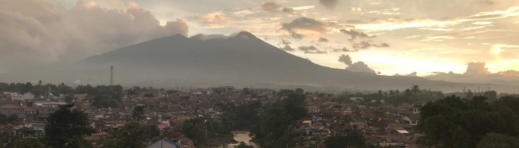
Facts Elevation: 2,563 m (8,409 ft) Prominence: 2,130 m Ribu category:  Tinggi Sedang Province:  Jawa Timur (East Java) Coordinates: -7.8204, 111.7569 Rating: Other names: Ngliman, Wilis World Ribus ID: 69029 Photos Bagging It! This peak is the highest point of a vast and complex mountain range most commonly-known as Wilis. There are three main peaks, each of […]

Gunung Liman Read More »

Gunung Bukittunggul

BUKITTUNGGUL

Gunung Bukittunggul is the highest peak in the mountainous area north of the city of Bandung, higher than both Tangkuban Parahu and Burangrang which lie further west. It is a major landmark when seen from other hills in the Bandung area and can be easily reached and climbed as a daytrip from Bandung or even Jakarta. Whilst there are no views to be had at the forested summit, the trek is not yet as hugely popular as most other significant peaks surrounding Bandung so if you are searching for relative solitude then this is a great choice.

Gunung Bukittunggul Read More »

Gunung Cikuray

CIKURAY

This Ribu is the highest peak in the whole of the Parahyangan/ Priangan highlands of West Java. It is a beautiful dormant cone and dominates the landscape near Garut. Given its height, it is actually fairly straightforward because on several hiking routes there are farm fields reaching high up the mountainside.

Gunung Cikuray Read More »

Gunung Salak

SALAK

Salak is one of the most accessible volcanoes from Jakarta but has not erupted since 1938. There are various routes on the mountain range and there is a great deal of variety to be found on its slopes – craters, wildlife, plants and numerous mountain peaks. It is the kind of mountain that cannot be fully explored in a single hike – you need to try various routes to discover the character of the mountain as a whole.

Gunung Salak Read More »

Chư Mư

Facts Elevation: 2,051 m (6,729 ft) Prominence: 1,505 m Ribu category:  Tinggi Sedang Region:  Southern Vietnam Coordinates: 12.6947, 108.9431 Rating: World Ribus ID: 68539 Bagging It! Unknown at present. Possibly also known as Nui Vong Phu. Practicalities Getting there: Unknown at present. Permits: Unknown at present. Water sources: Unknown at present. Local Average Monthly Rainfall (in Ho

Chư Mư Read More »

Núi Bi Doup

Facts Elevation: 2,287 m (7,503 ft) Prominence: 1,238 m Ribu category:  Tinggi Sedang Region:  Southern Vietnam Coordinates: 12.0908, 108.6625 Rating: World Ribus ID: 68600 Bagging It! Also known as Đỉnh Bidoup (2280m on the summit sign), local hikers are known to trek and camp here. Aparently the highest peak in Lam Dong Province. Practicalities Getting there: Hiked

Núi Bi Doup Read More »

Phou Kopi

Facts Elevation: 2,017 m (6,617 ft) Prominence: 1,272 m Ribu category:  Tinggi Sedang Region:  Southern Lao /  Central Vietnam Coordinates: 17.8133, 105.6800 Rating: World Ribus ID: 68584 Bagging It! Currently unknown. Practicalities Getting there: Currently unknown. Permits: Currently unknown. Water sources: Currently unknown. Local Average Monthly Rainfall (in Danang) Location Click on the blue arrow (top right) to

Phou Kopi Read More »

Ngoc Linh

Facts Elevation: 2,598 m (8,524 ft) Prominence: 2,208 m Ribu category:  Tinggi Sedang Region:  Central Vietnam Coordinates: 15.0692, 107.9750 Rating: World Ribus ID: 68502 Bagging It! Occasional guided expeditions are reported. Local hikers have definitely reached the top on numerous occasions where there is a summit sign with 2,605m on it. The massif is ecologically rich, home

Ngoc Linh Read More »

Phu Tả Tổng

Facts Elevation: 2,109 m (6,919 ft) Prominence: 1,470 m Ribu category:  Tinggi Sedang Region:  Northern Vietnam Coordinates: 22.3667, 102.6833 Rating: World Ribus ID: 68546 Bagging It! Unknown at present. Practicalities Getting there: Unknown at present. Permits: Unknown at present. Water sources: Unknown at present. Local Average Monthly Rainfall (in Hanoi) Location   Click on the blue arrow

Phu Tả Tổng Read More »

Phu Nam Tong

Facts Elevation: 2,124 m (6,969 ft) Prominence: 1,499 m Ribu category:  Tinggi Sedang Region:  Northern Vietnam Coordinates: 22.3000, 102.7308 Rating: World Ribus ID: 68540 Bagging It! Unknown at present. Practicalities Getting there: Unknown at present. Permits: Unknown at present. Water sources: Unknown at present. Local Average Monthly Rainfall (in Hanoi) Location   Click on the blue arrow

Phu Nam Tong Read More »

Scroll to Top