
Facts
- Elevation: 412 m (1,352 ft)
- Prominence: 332 m
- Peak category:
 Spesial
 - Region:
 Brunei
 - Coordinates: 4.3055, 114.4347
- Rating:
 (Bagged it? Be the first to rate it)
 Loading...
 - Other names: Mount Scott
Bagging It!
Bukit Teraja is probably the best out of a fairly small number of trekking options in Brunei. A half-day outing, but a full day from Bandar Seri Begawan and back given the distance, there’s a wooden ladder and some views at the top. The trailhead appears to be on the main road south of Mendaram Kechil and Wasai Wong Kadir Recreational Park, though there looks to be a wide track up to the top from Wong Kadir (popular locally for its waterfall).
Practicalities
-
- Getting there: Around 120km from Bandar Seri Begawan to the foot of the hill.
-
- Permits: Unknown
-
- Water sources: Unknown – take plenty of bottled drinks with you.
Local Average Monthly Rainfall in Brunei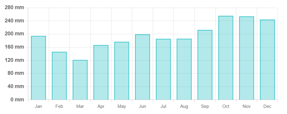
Location
Click on the blue arrow ![]() (top right) to see your current location on the map
(top right) to see your current location on the map
Origins and Meaning
It appears to be named after a local river, Sungai Teraja.