Author name: Dan

Hkakabo Razi

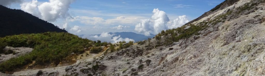
Facts Elevation: 5,881 m (19,295 ft) Prominence: 1,449 m Ribu category: Sangat Tinggi Region:  Eastern Myanmar Coordinates: 28.3279, 97.5352 Rating: World Ribus ID: 63404 Bagging It! Hkakabo Razi is officially the highest peak in Myanmar and traditionally considered the highest in Southeast Asia. Located in Kachin State, near the borders with India and Tibet, it is part […]

Hkakabo Razi Read More »

Phou Houang

Facts Elevation: 1,265 m (4,150 ft) Prominence: 1,040 m Ribu category:  Kurang Tinggi Region:  Southern Lao Coordinates: 15.9542, 106.0700 Rating: World Ribus ID: 68699 Bagging It! Currently unknown. Practicalities Getting there: Currently unknown. Permits: Currently unknown. Water sources: Currently unknown. Local Average Monthly Rainfall (in Pakse) Location   Click on the blue arrow (top right) to see

Phou Houang Read More »

Phou Malông

Facts Elevation: 1,286 m (4,219 ft) Prominence: 1,036 m Ribu category:  Kurang Tinggi Region:  Southern Lao Coordinates: 15.0242, 105.8283 Rating: World Ribus ID: 68703 Bagging It! Currently unknown. Practicalities Getting there: Currently unknown. Permits: Currently unknown. Water sources: Currently unknown. Local Average Monthly Rainfall (in Pakse) Location   Click on the blue arrow (top right) to see

Phou Malông Read More »

Phou Chomgnôk-Gnai

Facts Elevation: 1,380 m (4,528 ft) Prominence: 1,022 m Ribu category:  Kurang Tinggi Region:  Southern Lao Coordinates: 18.4267, 104.2183 Rating: World Ribus ID: 68711 Bagging It! Currently unknown. Practicalities Getting there: Currently unknown. Permits: Currently unknown. Water sources: Currently unknown. Local Average Monthly Rainfall (in Pakse) Location   Click on the blue arrow (top right) to see

Phou Chomgnôk-Gnai Read More »

Phou Louang

Facts Elevation: 1,397 m (4,583 ft) Prominence: 1,033 m Ribu category:  Kurang Tinggi Region:  Southern Lao Coordinates: 17.2942, 105.8758 Rating: World Ribus ID: 68704 Bagging It! Currently unknown. Practicalities Getting there: Currently unknown. Permits: Currently unknown. Water sources: Currently unknown. Local Average Monthly Rainfall (in Pakse) Location   Click on the blue arrow (top right) to see

Phou Louang Read More »

Phu Kao

Facts Elevation: 1,445 m (4,741 ft) Prominence: 1,312 m Ribu category:  Kurang Tinggi Region:  Southern Lao Coordinates: 14.8967, 105.8000 Rating: World Ribus ID: 68576 Bagging It! Currently unknown. Practicalities Getting there: Currently unknown. Permits: Currently unknown. Water sources: Currently unknown. Local Average Monthly Rainfall (in Pakse) Location   Click on the blue arrow (top right) to see

Phu Kao Read More »

Phou Ônghôn

Facts Elevation: 1,578 m (5,177 ft) Prominence: 1,028 m Ribu category:  Kurang Tinggi Region:  Southern Lao Coordinates: 18.0754, 104.8119 Rating: World Ribus ID: 68708 Bagging It! Currently unknown. Practicalities Getting there: Currently unknown. Permits: Currently unknown. Water sources: Currently unknown. Local Average Monthly Rainfall (in Pakse) Location   Click on the blue arrow (top right) to see

Phou Ônghôn Read More »

Phou Namsai

Facts Elevation: 1,588 m (5,210 ft) Prominence: 982 m Peak category:  Spesial Region:  Southern Lao Coordinates: 15.6197, 106.5089 Rating: Bagging It! Currently unknown. Practicalities Getting there: Currently unknown. Permits: Currently unknown. Water sources: Currently unknown. Local Average Monthly Rainfall (in Pakse) Location   Click on the blue arrow (top right) to see your current location on the

Phou Namsai Read More »

Phou Phiamay

Facts Elevation: 1,716 m (5,630 ft) Prominence: 1,475 m Ribu category:  Kurang Tinggi Region:  Southern Lao Coordinates: 15.3017, 106.4017 Rating: World Ribus ID: 68545 Bagging It! Currently unknown. Practicalities Getting there: Currently unknown. Permits: Currently unknown. Water sources: Currently unknown. Local Average Monthly Rainfall (in Pakse) Location   Click on the blue arrow (top right) to see

Phou Phiamay Read More »

Gunung Ambang

GUNUNG AMBANG

Gunung Ambang is an excellent volcanic crater complex and one of the easiest hikes in Sulawesi, requiring just over 2 hours to reach the summit via the crater from the trailhead. It is well-known for its bird life – you stand a very good chance of spotting eagles if you stay in the area for a couple of hours. The best starting point for Gunung Ambang is Desa Bongkudai Baru which is about 40 minutes by car from the small city of Kotamobagu.

Gunung Ambang Read More »

Scroll to Top