Facts
- Elevation: 2,507 m (8,225 ft)
- Prominence: 1,063 m
- Ribu category: Tinggi Sedang
- Province: Jambi
- Google Earth: kml
- Rating:

 (2 votes) Add your rating
 Loading...
 - Other names: none
- Eruptions: 1909, 1921
Photos


Bagging It!
Mount Sumbing (not to be confused with the peak of the same name in Central Java) is best approached from Tanjung Kasri (reachable by road from Jambi city or better from Sunggai Penuh). There are several craters near the summit. It has not erupted since 1921. There are hot springs on the southwest of the mountain. The neighbouring mountain just to the east is Gunung Nilo and, at 2,476m, is only 31 metres lower and may be worth climbing in its own right.
Local Accommodation
Practicalities
- Getting there: There are regular flights to Padang’s International airport from Indonesia and neighbouring countries. It is then a long 6-8 hours drive to the starting point. There is public transport and ‘travel cars’ for which you share a car with others but it will take you most of a day to reach Sunggai Penuh.
- Permits: Unknown
- Water sources: Unknown
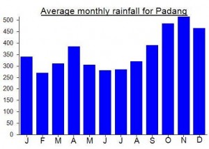
Local Average Monthly Rainfall (mm):
Location
Origins and Meaning
Mount Hare-lip. See also Java’s Gunung Sumbing which is also named after the cleft in the crater walls.
Veryyy delayed response. Nope, not safely…there is still a lot of primary forest. Safer to say 3 days rtn though you might do it in two (very long) days
Get to both Gunung Sumbing and the neighbouring peak of Gunung Nilo (almost as high) from Bangko (four hours from Jambi city)and then a rough (very) rough road on…Nilo Dingin or Sungai Lalang villages are the easiest startig points for both Gunung Masurai and Gunung Nilo. Between Gunung Nilo and Gunung Sumbing is a high altitude peat swamp area (Danau Kebut). Tickets to enter Kerinci Seblat National Park (both mountains are within the park) from National Park offices at Bangko on the main highway at Simpang Tengkorak (Skull crossroads).
Debbie, is it possible to reach Gunung Nilo & return to Nilo Dingin in 1 day? I presume a guide is needed, is one available in Nilo Dingin?
Frank