Facts
- Elevation: 1,220 m (4,003 ft)
- Prominence: 1,220 m
- Ribu category: Kurang Tinggi
- Province: Maluku Utara (North Moluccas)
- Google Earth: kml
- Rating:
 (Bagged it? Be the first to rate it)
 Loading...
 - Other names: none
Photos


Bagging It!
This Ribu is the highest point on Pulau Morotai.
Practicalities
-
- Getting there: Wings Air from Manado or speedboat from Halmahera.
- Accommodation: There are several losmen on Jl Raya Darane.
- Permits: Apparently not required but a local guide is highly recommended.
- Water sources: Unknown
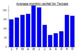
Local Average Monthly Rainfall (mm):
I attempted Gunung Sabatai (approximately 1,250 m), Pulau Morotai, Halmahera Utara, 7 September 2019. Failed – but it proved useful as a reccy. In Ternate, Ilham Abdullah, tour/birding guide (0852 9836 6292, excellent English), put me in touch with Muhlis Eso (0853 4070 0517, little English, muhlisesomuhlis@gmail.com), who acts as a local guide for Ilham on birding trips to Morotai. He, in turn, arranged for his older brother, In (aka Darwin, 0853 9964 2516, no English) to accompany us.
Wings flies daily between Ternate and Morotai – 45 minutes. Otherwise, boat (known as ‘speed’) from Dufa Dufa port, Ternate, to Sofifi on Halmahera, hire car to Tobelo, ‘speed’ again to Daruba on Morotai (one full day with an early start). There are several losmen on Jl Raya Darane. I stayed at Dodola losmen, Rp 200-300,000 per night – basic but quite adequate. The drier months are August-October. Excellent ikan bakar near the port.
I found three sets of coordinates for Gn Sabatai on the web – all different! The KML coordinates given in Gunung Bagging appear to be the most accurate. If you reach the true summit of Gn Sabatai, please record the coordinates and altitude, and report below. A GPS track would also be useful.
Muhlis specializes in collecting relics from WWII. When the Allies invaded Morotai in September 1944, the Japanese took refuge in the hinterland and established a headquarters in the vicinity of Gn Sabatai (https://en.wikipedia.org/wiki/Battle_of_Morotai). In 1974, a Japanese soldier, Teruo Nakamuro, was discovered near Gn Sabatai (https://en.wikipedia.org/wiki/Teruo_Nakamura). Muhlis’ knowledge of Sabatai is based on his search for relics at these sites.
His older brother, In (aka Darwin), is a very experienced ‘bushman’ who collects gaharu (a sap from a forest tree highly prized as incense). In has scouted the length and breadth of Morotai including the summit of Sabatai and knows the interior like ‘the back of his hand’.
It seems that few if any outsiders have climbed Gn Sabatai. The terrain does not seem too difficult. Once on the mountain, it is a long, steady climb to the summit, which is a high point on a range. But the challenge is the absence of tracks through the foothills and up the mountain itself. An experienced guide, such as In, who has knowledge of the terrain and stamina for cutting through the dense undergrowth, is essential. Muhlis proved to have little sense of distance and time required for the trek. Initially, he claimed that Sabatai could be climbed in one day – impossible! We reached a point on the Sabatai-Malako River at 14:00 hrs where my GPS showed a distance ‘as the crow flies’ of some 22 km remaining to the summit. And where my boots felt apart from wading up the river! Trek aborted at this stage.
We debriefed after the trek and reviewed possible approaches to the summit. Gn Sabatai lies south of the centre of the island and can be approached from various directions. Three approaches: (1) from Desa Wewemo on the east coast (where In lives in nearby Desa Mira); (2) from Desa Sabatai on the south coast (where Muhlis lives, and the route that I took – not recommended); and, (3) from a transmigration settlement, known as SPII, south-west of Gn Sabatai.
Google Earth shows tracks from Desa Wewemo to within several km of Gn Sabatai. These are old logging roads that are now eroded, overgrown and impassable even by motorbike. In informed that this approach would take three days. He concluded that the approach via SPII was the easiest and shortest. While In said that he could reach the summit from SPII in one day (which I believe given his stamina and knowledge of the terrain/forest), a trekker such as myself would need at least two, if not three, days; then, another one or two days for the return. Advice: wear long trousers otherwise your shins will be ripped to pieces by the undergrowth.
So, if you plan on climbing Gn Sabatai, allow four to five days for the trek; ensure that you have a guide such as In; and, don’t be fooled by ill-informed persons who claim that the return trek can be done in one day.
Hey Nicholas,
thanks for all these great information.
I tried to contact Pak Muhlis so but it looks that the mentioned email address is not working.
Best regards
Mikel
From local Alex Djangu: “Sabatai is the highest elevation in Morotai, you can acses from Sabatai village, they are nice forest to trekk on, easy for jungle survival”.
This Ribu certainly looks baggable on Google Earth – a track goes within about 2km of the summit. The airport is also very interesting – several runways in parallel, from US military efforts. Morotai island itself is listed as one of Indonesia’s ’10 New Balis’ (mainly for diving tourism potential) so if this takes off then the area is likely to become more and more accessible. May well visit eventually when I get sufficient time off work!