Sulawesi Selatan

Ambeso

GUNUNG AMBESO

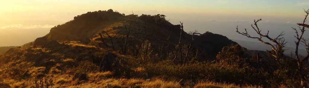
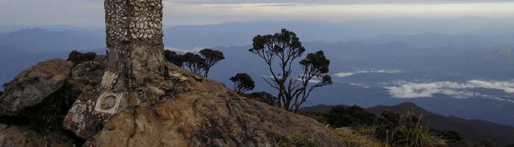
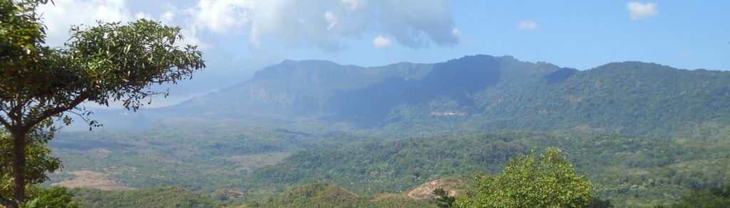
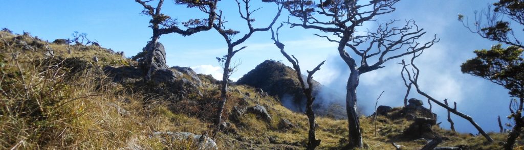
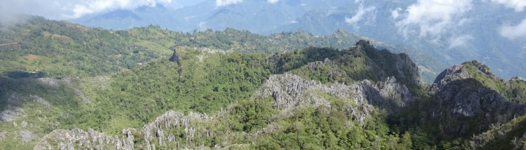
Tana Toraja is one of Indonesia’s most beautiful regions, and the little-known Gunung Ambeso is Toraja’s most fantastic half-day hike. Surrounded by karst ridges, fascinating local architecture and very friendly people, it may only be a matter of time before this mountain becomes much more famous.

Ambeso Read More »

Kambuno (Lantangunta)

Facts Elevation: 2,855 m (9,367 ft) Prominence: 1,199 m Ribu category: Tinggi Sedang Province: Sulawesi Selatan (South Sulawesi) Google Earth: kml Rating: Other names: none. Bagging It! The Bakosurtanal map labels the peak Bulu Lantangunta at 2,731m but local hikers know this mountain as Kambuno and it is clear from SRTM data that the summit

Kambuno (Lantangunta) Read More »

Balease (Tolangi)

Facts Elevation: 3,016 m (9,895 ft) Prominence: 1,587 m Ribu category: Sangat Tinggi Province: Sulawesi Selatan (South Sulawesi) Google Earth: kml Rating: Other names: Baliase Bagging It! We currently know very little about this peak – it has been climbed by students from hiking clubs in Makassar and the trek takes about one week in

Balease (Tolangi) Read More »

Rantemario

This Ribu is the highest mountain in Sulawesi and it is one of the least climbed 3000-metre plus peaks in Indonesia – maybe because it’s almost as much of an adventure reaching the start of the trail as it is actually climbing to the top. From the summit, the views over South and Southeast Sulawesi are stunning.

Rantemario Read More »

Tondongkarambu

Gunung Tondongkarambu is the highest mountain in the Bantimurung – Bulusaraung National Park area which was first explored by Alfred Russel Wallace in 1857 and is the second largest karst area in the world. Good hiking options in this very picturesque region include both Tondongkarambu and the more popular and shapely Bulusaraung. Apparently there is a small village named Tobalo in a remote part of the national park whose inhabitants are eleven albinos. It is said that this number must stay the same, so should one inhabitant die, a new albino from outside must come and take his or her place.

Tondongkarambu Read More »

Buntu Puang

Facts Elevation: 1,925 m (6,316 ft) Prominence: 852 m Ribu category: Spesial Province: Sulawesi Selatan (South Sulawesi) Google Earth: kml Rating: Other names: none. Bagging It! This is the closest major peak to the city of Palopo. There are several possible routes, including from the Latuppa area to the south. It can be hiked in

Buntu Puang Read More »

Bawakaraeng

Bawakaraeng is the most popular hike in South Sulawesi, because of both its proximity to Makassar and also its considerable height. The trail itself is in excellent condition although, since the enormous October 2004 landslide that took a large part of the mountainside down with it, the hike is a considerable 7-8 hours from the trailhead to the summit. The likelihood is that you will meet plenty of other hikers, especially on weekends, and perhaps even Tata Rasyid, the guardian of the mountain who climbs on a regular basis for the frequent traditional religious celebrations that take place up the mountain.

Bawakaraeng Read More »

Scroll to Top