Facts
- Elevation: 1,681 m (5,515 ft)
- Prominence: 1,030 m
- Ribu category: Kurang Tinggi
- Province: Sulawesi Barat (West Sulawesi)
- Google Earth: kml
- Rating:
 (Bagged it? Be the first to rate it)
 Loading...
 - Other names: none.
Bagging It!
This remote mountain peak is listed on the Bakosurtanal map as being 1,681m in elevation. The closest name on the map is Buttu Tinaungan which is around 1 kilometre to the north-east on a subsidiary top with an elevation of 1,155m.
Practicalities
-
- Getting there: Mamuju is the closest airport.
- Accommodation: Try Mamuju.
- Permits: Unknown.
- Water sources: Unknown.
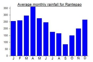
Local Average Monthly Rainfall (mm):